 vesseltracker.com
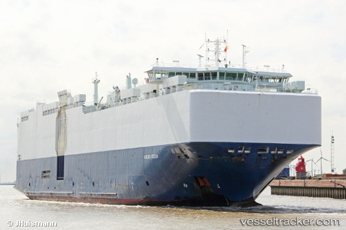
 VIKING OCEAN
Current Status
Where is the vessel?
VIKING OCEAN is currently in 55 nm W of Czarny Bor, based on AIS data received about 1h ago.
Latest AIS update:
Current position: 50.95646° N, 159.91476° E (55 nm W of Czarny Bor)
Average speed (last 7 days): Loading…
Average speed (last 30 days): Loading…
Vessel profile: VIKING OCEAN is a Vehicles Carrier with dimensions 167m x 28m.
This page combines live AIS, route history, probable destination signals, nearby traffic, and port activity for practical vessel monitoring.
The current position of vessel VIKING OCEAN is 50.95646 lat / 159.91476 lng. Updated: 2026-04-04 07:12:05 UTCNearest reference points:
- 16 nm SE of Petropavlovsk-Kamchatskiy
- Near Petropavlovsk-Kamchatskiy
- 11 nm NW of Petropavlovsk-Kamchatskiy
Currently sailing under the flag of Marshall Islands ![]()
VIKING OCEAN built in 2012 year
Deadweight:
12550 tDetails:
Live Vessel VIKING OCEAN Analytics (details, animations, etc.)
Recent AIS points (UTC):
2026-04-04 03:40:50 UTC · 51.28009, 161.08768 · SOG 14.1 kn · COG 254°2026-04-04 05:10:41 UTC · 51.15691, 160.59221 · SOG 13.3 kn · COG 260°
2026-04-04 06:50:27 UTC · 51.00718, 160.02631 · SOG 14.7 kn · COG 243°
2026-04-04 07:12:05 UTC · 50.95646, 159.91476 · SOG 14.4 kn · COG 239°