 vesseltracker.com
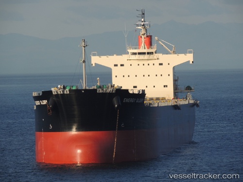
 Energy Glory
Current Status
Where is the vessel?
Energy Glory is currently in 151 nm S of HAMAJIMA, based on AIS data received less than 1h ago.
Latest AIS update:
Current position: 31.96833° N, 137.89500° E (151 nm S of HAMAJIMA)
Average speed (last 7 days): Loading…
Average speed (last 30 days): Loading…
Vessel profile: Energy Glory is a Bulk Carrier with dimensions 229m x 229m.
This page combines live AIS, route history, probable destination signals, nearby traffic, and port activity for practical vessel monitoring.
The current position of vessel Energy Glory is 31.96833 lat / 137.89500 lng. Updated: 2026-04-15 17:58:29 UTCNearest reference points:
- 133 nm S of OMAEZAKI
- 88 nm SE of Minachi
- 195 nm SE of Minachi
Currently sailing under the flag of Panama ![]()
Energy Glory built in 2013 year
Deadweight:
82123 tDetails:
Live Vessel Energy Glory Analytics (details, animations, etc.)
Recent AIS points (UTC):
2026-04-15 12:16:28 UTC · 31.96833, 137.92000 · SOG 1 kn · COG -1°2026-04-15 13:43:31 UTC · 31.96167, 137.90668 · SOG 0 kn · COG -1°
2026-04-15 16:07:32 UTC · 31.96333, 137.89500 · SOG 0 kn · COG -1°
2026-04-15 17:58:29 UTC · 31.96833, 137.89500 · SOG 0 kn · COG -1°