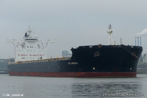
.
Vessel photo of MERCHANT MARINER (IMO 9522647) vesseltracker.com

GR flag MERCHANT MARINER

Vessel type: Bulk Carrier | IMO: 9522647 | MMSI: MMSI: 241721000
Call sign: SVDI8 | Dimensions: 292 m x 292 m
Current Status

Where is the vessel?

MERCHANT MARINER is currently in 235 nm SE of Santa Venera, based on AIS data received less than 1h ago.

Latest AIS update:

Current position: 33.57488° N, 147.25528° E (235 nm SE of Santa Venera)

Average speed (last 7 days): Loading…

Average speed (last 30 days): Loading…

Vessel profile: MERCHANT MARINER is a Bulk Carrier with dimensions 292m x 292m.

This page combines live AIS, route history, probable destination signals, nearby traffic, and port activity for practical vessel monitoring.

The current position of vessel MERCHANT MARINER is 33.57488 lat / 147.25528 lng. Updated: 2026-04-02 17:55:22 UTC
Nearest reference points:
  • Open sea, approx. 400 nm off the nearest listed port
  • Open sea, approx. 402 nm off the nearest listed port
  • Open sea, approx. 405 nm off the nearest listed port

Currently sailing under the flag of Greece GR flag

MERCHANT MARINER built in 2010 year

Deadweight:
179570 t

Details:

Live Vessel MERCHANT MARINER Analytics (details, animations, etc.)


Recent AIS points (UTC):
2026-04-02 12:17:29 UTC · 33.48167, 146.03333 · SOG 11 kn · COG -1°
2026-04-02 14:08:38 UTC · 33.51667, 146.44833 · SOG 11 kn · COG -1°
2026-04-02 15:49:36 UTC · 33.54417, 146.81563 · SOG 10.7 kn · COG 83°
2026-04-02 17:55:22 UTC · 33.57488, 147.25528 · SOG 10.3 kn · COG 83°

Track of the vessel in the last 60 days


UTC: --
Start: -- Track timeline (UTC) End: --
Encountered: --


Link to the map:


Find another ship

MERCHANT_MARINER (241721000) last ports (portcalls and passsages)

Selat Lombok | 2025-08-26 09:07:41
PORT WALCOTT | 2025-06-16 01:24:39
Samson Point | 2025-06-15 23:20:49
Qingdao | 2025-04-03 23:25:20
Selat Lombok | 2025-03-17 22:12:47
Samson Point | 2025-03-11 16:58:32
PORT WALCOTT | 2025-03-11 03:22:53
Samson Point | 2025-03-07 16:04:14
Samson Point | 2025-03-03 15:58:50
Selat Lombok | 2025-02-28 11:32:28
Selat Lombok | 2025-02-01 14:29:18
PORT WALCOTT | 2025-01-26 12:41:44
Samson Point | 2025-01-25 14:16:20
Bayuquan | 2025-01-04 22:06:34
Selat Lombok | 2024-12-17 19:12:48
PORT WALCOTT | 2024-12-13 00:49:25
Samson Point | 2024-12-11 07:27:30
Selat Lombok | 2024-12-07 23:41:53
JINGTANG | 2024-11-22 08:58:02
Samson Point | 2024-10-21 22:15:50
Samson Point | 2024-10-17 21:25:54
Hong Kong | 2024-10-04 03:47:03
Fangcheng | 2024-09-23 03:17:53
Selat Lombok | 2024-09-13 10:06:40
Dampier | 2024-09-08 01:35:26
Selat Lombok | 2024-09-01 18:02:44
Bayuquan | 2024-08-15 15:15:58
Selat Lombok | 2024-07-28 23:16:05
Samson Point | 2024-07-23 04:51:28
Samson Point | 2024-07-19 04:16:04
Samson Point | 2024-07-15 03:17:35
Samson Point | 2024-07-11 02:22:25
Bayuquan | 2024-06-22 07:48:39
Selat Lombok | 2024-06-08 06:59:10
Samson Point | 2024-06-03 02:05:10
Selat Lombok | 2024-05-19 07:59:23
Taicang | 2024-05-08 08:42:32
Nantong | 2024-05-06 00:59:09
Wusong | 2024-05-05 02:25:21
Jingjiang | 2024-05-04 21:07:17
Selat Lombok | 2024-04-17 08:22:26
Dampier | 2024-04-13 00:38:34
Selat Lombok | 2024-03-03 10:04:57
Dampier | 2024-02-27 19:32:55
Selat Lombok | 2024-02-22 05:08:56
Fangcheng | 2024-02-12 23:06:32
Fangcheng | 2024-02-08 22:30:53
Selat Lombok | 2024-01-25 17:48:48
Dampier | 2024-01-20 13:15:04
Selat Lombok | 2024-01-16 08:29:13
Pohang | 2023-11-23 02:59:18
Pohang | 2023-11-19 02:58:57
Pohang | 2023-11-15 02:34:21
Selat Lombok | 2023-10-26 13:12:44
Port Headland | 2023-10-22 13:29:43
Yosu | 2023-10-08 17:33:10
Yosu | 2023-10-02 11:31:49
Selat Lombok | 2023-07-26 01:16:54
Port Headland | 2023-07-21 09:26:36
Tsugaru-Kaikyo | 2023-05-23 12:56:27
Victoria | 2023-05-06 01:34:39
Victoria | 2023-04-29 01:17:02
Tsugaru-Kaikyo | 2023-04-12 10:55:50
Pohang | 2023-04-09 09:36:13
Pohang | 2023-04-03 07:44:54
Gladstone Harbor | 2023-03-11 23:54:08
Port Kembla | 2023-02-26 05:51:31
Pohang | 2023-01-29 11:10:43