 vesseltracker.com
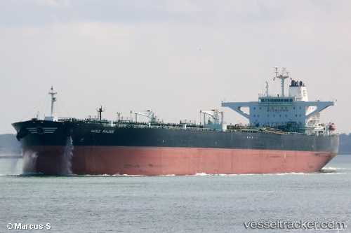
 ST. NIKOLAS
Current Status
Where is the vessel?
ST. NIKOLAS is currently in Near Az Zarqa Island, based on AIS data received about 2h ago.
Latest AIS update:
Current position: 25.01334° N, 53.06747° E (Near Az Zarqa Island)
Average speed (last 7 days): Loading…
Average speed (last 30 days): Loading…
Vessel profile: ST. NIKOLAS is a Crude Oil Tanker with dimensions m x m.
This page combines live AIS, route history, probable destination signals, nearby traffic, and port activity for practical vessel monitoring.
The current position of vessel ST. NIKOLAS is 25.01334 lat / 53.06747 lng. Updated: 2026-04-01 12:28:20 UTCNearest reference points:
- Near Das Island
- Near Yas Island
- Near Ar Ruways
Currently sailing under the flag of Marshall Islands ![]()
Details:
Live Vessel ST. NIKOLAS Analytics (details, animations, etc.)
Recent AIS points (UTC):
2026-04-01 08:22:09 UTC · 25.01321, 53.06768 · SOG 0 kn · COG 341°2026-04-01 09:42:49 UTC · 25.01333, 53.06736 · SOG 0.2 kn · COG 357°
2026-04-01 10:48:11 UTC · 25.01347, 53.06706 · SOG 0.2 kn · COG -1°
2026-04-01 12:28:20 UTC · 25.01334, 53.06747 · SOG 0 kn · COG -1°