 vesseltracker.com
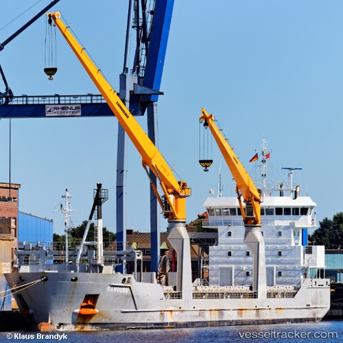
 Bandura
Current Status
Where is the vessel?
Bandura is currently in 165 nm SE of Pinos Puente, based on AIS data received about 2h ago.
Latest AIS update:
Current position: 34.93167° N, 32.99333° W (165 nm SE of Pinos Puente)
Average speed (last 7 days): Loading…
Average speed (last 30 days): Loading…
Vessel profile: Bandura is a Multi Purpose Carrier with dimensions 118m x 16m.
This page combines live AIS, route history, probable destination signals, nearby traffic, and port activity for practical vessel monitoring.
The current position of vessel Bandura is 34.93167 lat / -32.99333 lng. Updated: 2026-04-09 18:03:36 UTCNearest reference points:
- 107 nm SE of Sariseki
Currently sailing under the flag of Netherlands ![]()
Bandura built in 2010 year
Deadweight:
8217 tDetails:
Live Vessel Bandura Analytics (details, animations, etc.)
Recent AIS points (UTC):
2026-04-09 12:18:36 UTC · 34.96833, -32.94833 · SOG 0 kn · COG -1°2026-04-09 14:25:48 UTC · 34.95575, -32.97033 · SOG 0.3 kn · COG 301°
2026-04-09 15:51:37 UTC · 34.94667, -32.97833 · SOG 0 kn · COG -1°
2026-04-09 18:03:36 UTC · 34.93167, -32.99333 · SOG 0 kn · COG -1°