 vesseltracker.com
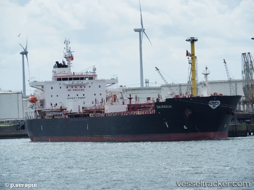
 DALMACIJA
Current Status
Where is the vessel?
DALMACIJA is currently in 247 nm W of Iba, based on AIS data received less than 1h ago.
Latest AIS update:
Current position: 14.87470° N, 115.72800° E (247 nm W of Iba)
Average speed (last 7 days): Loading…
Average speed (last 30 days): Loading…
Vessel profile: DALMACIJA is a Chemical/Oil Products Tanker with dimensions 32m x 183m.
This page combines live AIS, route history, probable destination signals, nearby traffic, and port activity for practical vessel monitoring.
The current position of vessel DALMACIJA is 14.8747 lat / 115.728 lng. Updated: 2026-03-30 00:01:11 UTCNearest reference points:
- 222 nm W of Iba
- 282 nm E of Tan Cang Qui Nhon
- 232 nm E of Tan Cang Qui Nhon
Currently sailing under the flag of Malta ![]()
DALMACIJA built in 2015 year
Deadweight:
49991 tDetails:
Live Vessel DALMACIJA Analytics (details, animations, etc.)
Recent AIS points (UTC):
2026-03-29 17:22:52 UTC · 15.90500, 116.66700 · SOG 12 kn · COG -1°2026-03-29 20:22:53 UTC · 15.44670, 116.24800 · SOG 12 kn · COG -1°
2026-03-29 21:46:56 UTC · 15.22330, 116.04500 · SOG 12 kn · COG -1°
2026-03-30 00:01:11 UTC · 14.87470, 115.72800 · SOG 12.4 kn · COG 219°