 vesseltracker.com
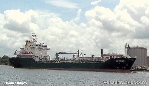
 PB CHALITA
Current Status
Where is the vessel?
PB CHALITA is currently in Near Pulau Tikus, based on AIS data received about 1h ago.
Latest AIS update:
Current position: 5.50499° N, 100.31856° E (Near Pulau Tikus)
Average speed (last 7 days): Loading…
Average speed (last 30 days): Loading…
Vessel profile: PB CHALITA is a Oil/Chemical Tanker with dimensions m x m.
This page combines live AIS, route history, probable destination signals, nearby traffic, and port activity for practical vessel monitoring.
The current position of vessel PB CHALITA is 5.50499 lat / 100.31856 lng. Updated: 2026-03-29 15:22:04 UTCNearest reference points:
- Near Pulau Tikus
- Near Mak Mandin
- 10 nm NW of Air Itam/Penang
Currently sailing under the flag of Panama ![]()
Details:
Live Vessel PB CHALITA Analytics (details, animations, etc.)
Recent AIS points (UTC):
2026-03-28 13:35:53 UTC · 5.36529, 100.36550 · SOG 0 kn · COG 356°2026-03-28 13:35:53 UTC · 5.36529, 100.36550 · SOG 0 kn · COG 356°
2026-03-28 13:35:53 UTC · 5.36529, 100.36550 · SOG 0 kn · COG 356°
2026-03-29 15:22:04 UTC · 5.50499, 100.31856 · SOG 8.4 kn · COG 328°