 vesseltracker.com
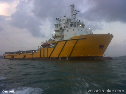
 LOGINDO ENERGY
Current Status
Where is the vessel?
LOGINDO ENERGY is currently in Near BATU AMPAR, based on AIS data received about 1h ago.
Latest AIS update:
Current position: 1.15864° N, 103.97488° E (Near BATU AMPAR)
Average speed (last 7 days): Loading…
Average speed (last 30 days): Loading…
Vessel profile: LOGINDO ENERGY is a Offshore Tug/Supply Ship with dimensions 15m x 78m.
This page combines live AIS, route history, probable destination signals, nearby traffic, and port activity for practical vessel monitoring.
The current position of vessel LOGINDO ENERGY is 1.15864 lat / 103.97488 lng. Updated: 2026-04-02 06:00:11 UTCNearest reference points:
- Near BATU AMPAR
- Near Sambu
- Near Sekupang
Currently sailing under the flag of Indonesia ![]()
LOGINDO ENERGY built in 2013 year
Deadweight:
3307 tDetails:
Live Vessel LOGINDO ENERGY Analytics (details, animations, etc.)
Recent AIS points (UTC):
2026-04-01 23:56:39 UTC · 1.15883, 103.97474 · SOG 0 kn · COG 80°2026-04-02 02:27:40 UTC · 1.15868, 103.97482 · SOG 0 kn · COG 36°
2026-04-02 03:33:48 UTC · 1.15868, 103.97481 · SOG 0 kn · COG 10°
2026-04-02 06:00:11 UTC · 1.15864, 103.97488 · SOG 0 kn · COG 336°