 vesseltracker.com
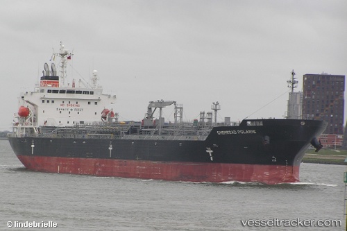
 CHEMROAD POLARIS
Current Status
Where is the vessel?
CHEMROAD POLARIS is currently in Open sea, approx. 442 nm off the nearest listed port, based on AIS data received less than 1h ago.
Latest AIS update:
Current position: 11.31600° S, 0.79263° E (Open sea, approx. 442 nm off the nearest listed port)
Average speed (last 7 days): Loading…
Average speed (last 30 days): Loading…
Vessel profile: CHEMROAD POLARIS is a Chemical/Oil Products Tanker with dimensions 179m x 29m.
This page combines live AIS, route history, probable destination signals, nearby traffic, and port activity for practical vessel monitoring.
The current position of vessel CHEMROAD POLARIS is -11.31600 lat / 0.79263 lng. Updated: 2026-04-03 00:02:15 UTCNearest reference points:
- Open sea, approx. 442 nm off the nearest listed port
- Open sea, approx. 436 nm off the nearest listed port
- Open sea, approx. 451 nm off the nearest listed port
Currently sailing under the flag of Panama ![]()
CHEMROAD POLARIS built in 2014 year
Deadweight:
35923 tDetails:
Live Vessel CHEMROAD POLARIS Analytics (details, animations, etc.)
Recent AIS points (UTC):
2026-04-02 18:21:33 UTC · -10.34524, 0.08378 · SOG 12.6 kn · COG 142°2026-04-02 19:42:15 UTC · -10.57164, 0.25688 · SOG 12.8 kn · COG 146°
2026-04-02 21:45:52 UTC · -10.92752, 0.51494 · SOG 12.8 kn · COG 146°
2026-04-03 00:02:15 UTC · -11.31600, 0.79263 · SOG 12.2 kn · COG 144°