 vesseltracker.com
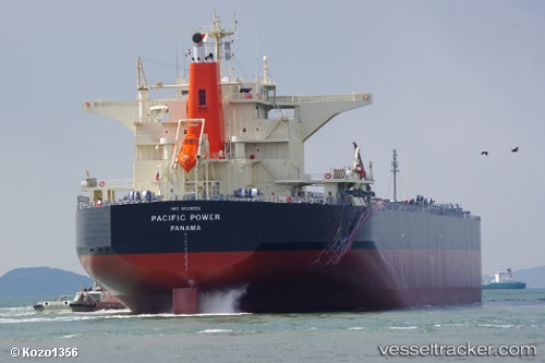
Pacific Power
Current StatusWhere is the vessel?
Pacific Power is currently in Near NACALA PORTO, based on AIS data received less than 1h ago.
Latest AIS update:
Current position: 14.53195° S, 40.65573° E (Near NACALA PORTO)
Average speed (last 7 days): Loading…
Average speed (last 30 days): Loading…
Vessel profile: Pacific Power is a Bulk Carrier with dimensions 43m x 245m.
This page combines live AIS, route history, probable destination signals, nearby traffic, and port activity for practical vessel monitoring.
The current position of vessel Pacific Power is -14.53195 lat / 40.65573 lng. Updated: 2026-04-02 17:42:57 UTCNearest reference points:
- Near NACALA PORTO
- 10 nm N of NACALA PORTO
Details:
Live Vessel Pacific Power Analytics (details, animations, etc.)
Recent AIS points (UTC):
2026-04-02 12:17:29 UTC · -14.53192, 40.65573 · SOG 0 kn · COG -1°2026-04-02 14:21:46 UTC · -14.53195, 40.65571 · SOG 0 kn · COG 191°
2026-04-02 16:03:48 UTC · -14.53198, 40.65576 · SOG 0 kn · COG 191°
2026-04-02 17:42:57 UTC · -14.53195, 40.65573 · SOG 0 kn · COG -1°