 vesseltracker.com
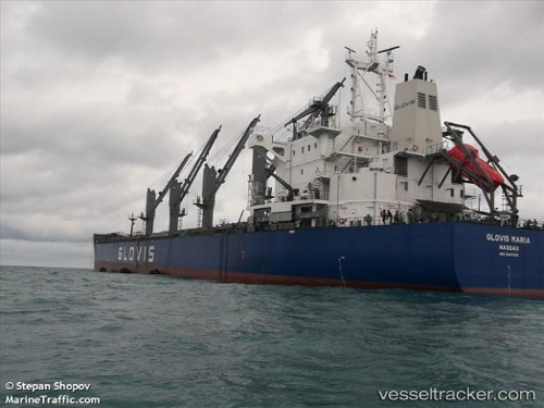
 Glovis Maria
Current Status
Where is the vessel?
Glovis Maria is currently in 17 nm E of Beira, based on AIS data received about 1h ago.
Latest AIS update:
Current position: 19.91167° S, 35.10500° E (17 nm E of Beira)
Average speed (last 7 days): Loading…
Average speed (last 30 days): Loading…
Vessel profile: Glovis Maria is a Bulk Carrier with dimensions 188m x 188m.
This page combines live AIS, route history, probable destination signals, nearby traffic, and port activity for practical vessel monitoring.
The current position of vessel Glovis Maria is -19.91167 lat / 35.10500 lng. Updated: 2026-03-29 17:41:24 UTCNearest reference points:
- 14 nm E of Beira
- 21 nm SE of Beira
- 24 nm SE of Beira
Currently sailing under the flag of Bahamas ![]()
Glovis Maria built in 2012 year
Deadweight:
55705 tDetails:
Live Vessel Glovis Maria Analytics (details, animations, etc.)
Recent AIS points (UTC):
2026-03-29 12:10:40 UTC · -19.91101, 35.10269 · SOG 0.6 kn · COG 92°2026-03-29 14:19:35 UTC · -19.91078, 35.10612 · SOG 0.6 kn · COG 222°
2026-03-29 15:43:40 UTC · -19.91199, 35.10646 · SOG 0.1 kn · COG 254°
2026-03-29 17:41:24 UTC · -19.91167, 35.10500 · SOG 0 kn · COG -1°