 vesseltracker.com
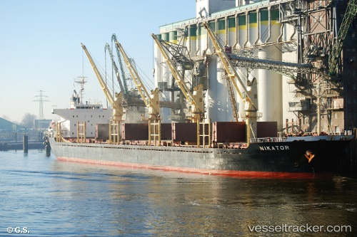
 NIKATOR
Current Status
Where is the vessel?
NIKATOR is currently in Near Choa Chu Kang, based on AIS data received less than 1h ago.
Latest AIS update:
Current position: 1.25580° N, 103.89188° E (Near Choa Chu Kang)
Average speed (last 7 days): Loading…
Average speed (last 30 days): Loading…
Vessel profile: NIKATOR is a Bulk Carrier with dimensions m x m.
This page combines live AIS, route history, probable destination signals, nearby traffic, and port activity for practical vessel monitoring.
The current position of vessel NIKATOR is 1.25580 lat / 103.89188 lng. Updated: 2026-03-31 10:18:18 UTCNearest reference points:
- Near Choa Chu Kang
- Near Tampines
- Near Singapore
Currently sailing under the flag of Antigua and Barbuda ![]()
Details:
Live Vessel NIKATOR Analytics (details, animations, etc.)
Recent AIS points (UTC):
2026-03-31 03:33:20 UTC · 1.25544, 103.89193 · SOG 0.3 kn · COG 98°2026-03-31 05:54:20 UTC · 1.25647, 103.89430 · SOG 0.1 kn · COG 247°
2026-03-31 07:39:20 UTC · 1.25660, 103.89440 · SOG 0.1 kn · COG 218°
2026-03-31 10:18:18 UTC · 1.25580, 103.89188 · SOG 0.1 kn · COG 98°