 vesseltracker.com
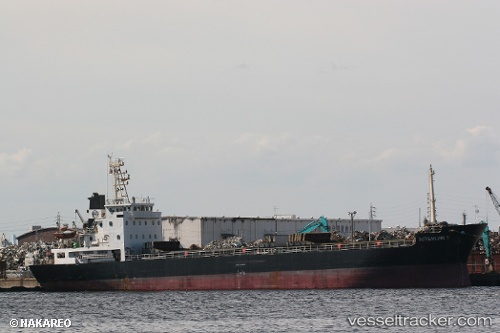
 LADY MIA
Current Status
Where is the vessel?
LADY MIA is currently in Near Tripoli, based on AIS data received about 2h ago.
Latest AIS update:
Current position: 34.48265° N, 35.83322° E (Near Tripoli)
Average speed (last 7 days): Loading…
Average speed (last 30 days): Loading…
Vessel profile: LADY MIA is a Cargo with dimensions m x m.
This page combines live AIS, route history, probable destination signals, nearby traffic, and port activity for practical vessel monitoring.
The current position of vessel LADY MIA is 34.48265 lat / 35.83322 lng. Updated: 2026-04-16 10:10:56 UTCNearest reference points:
- Near Tripoli
- Near Tartous
- Near Zouk
Currently sailing under the flag of Palau ![]()
Details:
Live Vessel LADY MIA Analytics (details, animations, etc.)
Recent AIS points (UTC):
2026-04-16 05:53:00 UTC · 34.48313, 35.83306 · SOG 0.3 kn · COG 50°2026-04-16 08:16:57 UTC · 34.48280, 35.83334 · SOG 0.5 kn · COG 70°
2026-04-16 09:52:58 UTC · 34.48275, 35.83315 · SOG 0.5 kn · COG 73°
2026-04-16 10:10:56 UTC · 34.48265, 35.83322 · SOG 0.4 kn · COG 19°