 vesseltracker.com
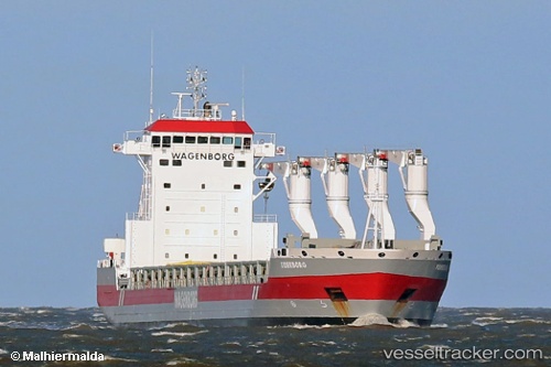
 Tiberborg
Current Status
Where is the vessel?
Tiberborg is currently in 34 nm S of CLARK'S HARBOUR, based on AIS data received about 1h ago.
Latest AIS update:
Current position: 42.88345° N, 65.58220° W (34 nm S of CLARK'S HARBOUR)
Average speed (last 7 days): Loading…
Average speed (last 30 days): Loading…
Vessel profile: Tiberborg is a Multi Purpose Carrier with dimensions 173m x 22m.
This page combines live AIS, route history, probable destination signals, nearby traffic, and port activity for practical vessel monitoring.
The current position of vessel Tiberborg is 42.88345 lat / -65.58220 lng. Updated: 2026-03-26 23:23:35 UTCNearest reference points:
- Near Lower Woods Harbour
- Near Wedgeport
- Near Liverpool
Currently sailing under the flag of Netherlands ![]()
Tiberborg built in 2013 year
Deadweight:
21301 tDetails:
Live Vessel Tiberborg Analytics (details, animations, etc.)
Recent AIS points (UTC):
2026-03-26 17:33:14 UTC · 41.69667, -66.96000 · SOG 16 kn · COG -1°2026-03-26 20:15:41 UTC · 42.25500, -66.30500 · SOG 17 kn · COG -1°
2026-03-26 21:45:49 UTC · 42.55500, -65.96500 · SOG 16 kn · COG -1°
2026-03-26 23:23:35 UTC · 42.88345, -65.58220 · SOG 16 kn · COG 38°