 vesseltracker.com
 E NINE
Current Status
Where is the vessel?
E NINE is currently in Near Pepel, based on AIS data received about 2h ago.
Latest AIS update:
Current position: 8.57464° N, 13.05581° W (Near Pepel)
Average speed (last 7 days): Loading…
Average speed (last 30 days): Loading…
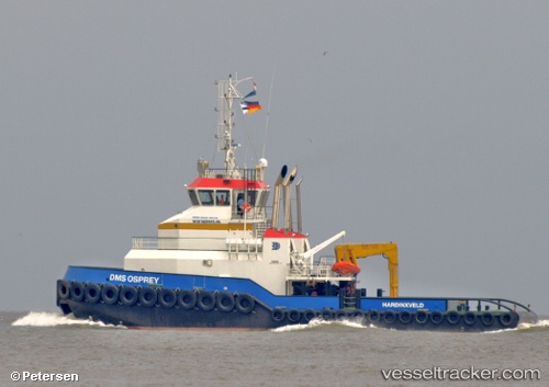
Vessel profile: E NINE is a Tug with dimensions m x m.
This page combines live AIS, route history, probable destination signals, nearby traffic, and port activity for practical vessel monitoring.
The current position of vessel E NINE is 8.57464 lat / -13.05581 lng. Updated: 2026-03-26 05:37:59 UTCNearest reference points:
- Near Kissy
- Near NASSIT
- 28 nm S of Conakry
Details:
Live Vessel E NINE Analytics (details, animations, etc.)
Recent AIS points (UTC):
2026-03-26 00:11:41 UTC · 8.50921, -13.11321 · SOG 5.2 kn · COG 46°2026-03-26 02:00:12 UTC · 8.57517, -13.05329 · SOG 1.3 kn · COG 261°
2026-03-26 03:28:53 UTC · 8.57446, -13.05571 · SOG 0 kn · COG 222°
2026-03-26 05:37:59 UTC · 8.57464, -13.05581 · SOG 0 kn · COG 222°