 vesseltracker.com
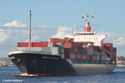
 SMOOTH WIND
Current Status
Where is the vessel?
SMOOTH WIND is currently in 15 nm N of Hibiki-Nada, based on AIS data received about 1h ago.
Latest AIS update:
Current position: 34.25040° N, 130.43291° E (15 nm N of Hibiki-Nada)
Average speed (last 7 days): Loading…
Average speed (last 30 days): Loading…
Vessel profile: SMOOTH WIND is a Container Ship with dimensions m x m.
This page combines live AIS, route history, probable destination signals, nearby traffic, and port activity for practical vessel monitoring.
The current position of vessel SMOOTH WIND is 34.25040 lat / 130.43291 lng. Updated: 2026-04-15 12:14:19 UTCNearest reference points:
- Near Hibiki-Nada
- 29 nm NW of Hibiki-Nada
- 30 nm NW of Hibiki-Nada
Currently sailing under the flag of Liberia ![]()
Details:
Live Vessel SMOOTH WIND Analytics (details, animations, etc.)
Recent AIS points (UTC):
2026-04-15 05:57:38 UTC · 33.78748, 131.62653 · SOG 14.7 kn · COG 279°2026-04-15 07:35:29 UTC · 33.85893, 131.21590 · SOG 11.3 kn · COG 296°
2026-04-15 09:42:39 UTC · 33.95560, 130.86838 · SOG 7 kn · COG 33°
2026-04-15 12:14:19 UTC · 34.25040, 130.43291 · SOG 11.2 kn · COG 302°