 vesseltracker.com
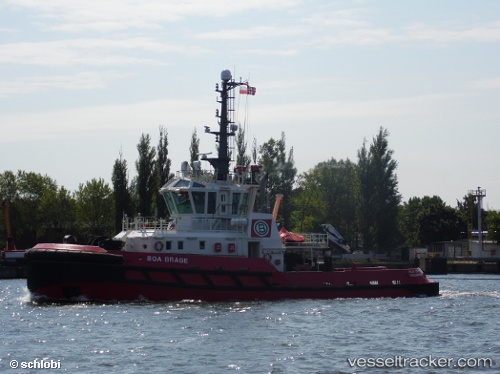
 BOA BRAGE
Current Status
Where is the vessel?
BOA BRAGE is currently in 20 nm NW of Sigri Lesvou, based on AIS data received about 1h ago.
Latest AIS update:
Current position: 39.48435° N, 25.58218° E (20 nm NW of Sigri Lesvou)
Average speed (last 7 days): Loading…
Average speed (last 30 days): Loading…
Vessel profile: BOA BRAGE is a Tug with dimensions m x m.
This page combines live AIS, route history, probable destination signals, nearby traffic, and port activity for practical vessel monitoring.
The current position of vessel BOA BRAGE is 39.48435 lat / 25.58218 lng. Updated: 2026-03-30 21:23:32 UTCNearest reference points:
- 16 nm NW of Sigri Lesvou
- 14 nm NW of Baba Point
- 14 nm SW of Bozcaada
Currently sailing under the flag of Malta ![]()
Details:
Live Vessel BOA BRAGE Analytics (details, animations, etc.)
Recent AIS points (UTC):
2026-03-30 15:42:34 UTC · 40.27248, 26.53000 · SOG 15.2 kn · COG 233°2026-03-30 17:47:44 UTC · 40.02485, 26.04996 · SOG 12.3 kn · COG 267°
2026-03-30 19:48:03 UTC · 39.74583, 25.75342 · SOG 11.3 kn · COG 206°
2026-03-30 21:23:32 UTC · 39.48435, 25.58218 · SOG 11 kn · COG 204°