 vesseltracker.com
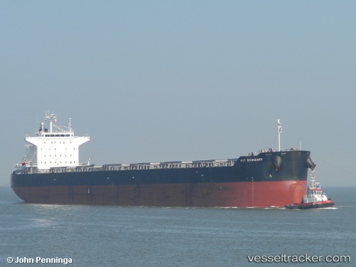
 ALLIANCE
Current Status
Where is the vessel?
ALLIANCE is currently in Near Paranagua, based on AIS data received less than 1h ago.
Latest AIS update:
Current position: 25.50120° S, 48.50320° W (Near Paranagua)
Average speed (last 7 days): Loading…
Average speed (last 30 days): Loading…
Vessel profile: ALLIANCE is a Bulk Carrier with dimensions 229m x 32m.
This page combines live AIS, route history, probable destination signals, nearby traffic, and port activity for practical vessel monitoring.
The current position of vessel ALLIANCE is -25.5012 lat / -48.5032 lng. Updated: 2026-04-01 00:19:44 UTCNearest reference points:
- 24 nm E of Caioba
- 32 nm E of Caioba
- 10 nm NE of CAMBORIU
Currently sailing under the flag of Malta ![]()
ALLIANCE built in 2010 year
Deadweight:
83369 tDetails:
Live Vessel ALLIANCE Analytics (details, animations, etc.)
Recent AIS points (UTC):
2026-03-31 17:37:39 UTC · -25.50110, -48.50320 · SOG 0 kn · COG 261°2026-03-31 20:16:37 UTC · -25.50120, -48.50320 · SOG 0 kn · COG 261°
2026-03-31 22:07:57 UTC · -25.50120, -48.50320 · SOG 0 kn · COG 261°
2026-04-01 00:19:44 UTC · -25.50120, -48.50320 · SOG 0 kn · COG 261°