 vesseltracker.com
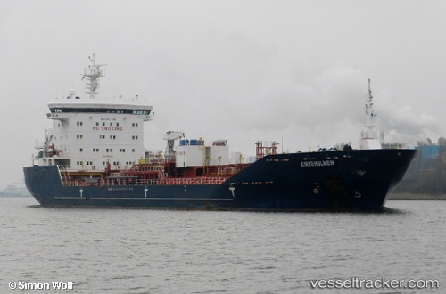
 Kirkeholmen
Current Status
Where is the vessel?
Kirkeholmen is currently in 17 nm NW of Middelkerke, based on AIS data received about 1h ago.
Latest AIS update:
Current position: 51.42273° N, 2.59160° E (17 nm NW of Middelkerke)
Average speed (last 7 days): Loading…
Average speed (last 30 days): Loading…
Vessel profile: Kirkeholmen is a Chemical Oil Products Tanker with dimensions 144m x 144m.
This page combines live AIS, route history, probable destination signals, nearby traffic, and port activity for practical vessel monitoring.
The current position of vessel Kirkeholmen is 51.42273 lat / 2.59160 lng. Updated: 2026-03-26 22:15:54 UTCNearest reference points:
- 13 nm NW of Middelkerke
- Near Lombardsijde
- Near Oostende
Currently sailing under the flag of Panama ![]()
Kirkeholmen built in 2010 year
Deadweight:
16730 tDetails:
Live Vessel Kirkeholmen Analytics (details, animations, etc.)
Recent AIS points (UTC):
2026-03-26 15:45:10 UTC · 51.42253, 2.59348 · SOG 0.3 kn · COG 331°2026-03-26 17:30:09 UTC · 51.42285, 2.59445 · SOG 0 kn · COG 307°
2026-03-26 19:24:07 UTC · 51.42372, 2.59487 · SOG 0.1 kn · COG 282°
2026-03-26 22:15:54 UTC · 51.42273, 2.59160 · SOG 0.1 kn · COG 42°