 vesseltracker.com
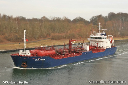
 KING FISHER
Current Status
Where is the vessel?
KING FISHER is currently in Near Paramaribo Zorg en Hoop Airport, based on AIS data received less than 1h ago.
Latest AIS update:
Current position: 5.79060° N, 55.16020° W (Near Paramaribo Zorg en Hoop Airport)
Average speed (last 7 days): Loading…
Average speed (last 30 days): Loading…
Vessel profile: KING FISHER is a Oil Products Tanker with dimensions m x m.
This page combines live AIS, route history, probable destination signals, nearby traffic, and port activity for practical vessel monitoring.
The current position of vessel KING FISHER is 5.79060 lat / -55.16020 lng. Updated: 2026-03-29 19:32:21 UTCNearest reference points:
- Near Paramaribo Zorg en Hoop Airport
- 38 nm NW of Jarikaba
Currently sailing under the flag of United Kingdom ![]()
Details:
Live Vessel KING FISHER Analytics (details, animations, etc.)
Recent AIS points (UTC):
2026-03-29 14:20:22 UTC · 5.79057, -55.16025 · SOG 0 kn · COG 335°2026-03-29 15:23:23 UTC · 5.79058, -55.16025 · SOG 0 kn · COG 335°
2026-03-29 17:29:26 UTC · 5.79059, -55.16024 · SOG 0 kn · COG 335°
2026-03-29 19:32:21 UTC · 5.79060, -55.16020 · SOG 0 kn · COG 335°