 vesseltracker.com
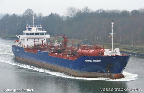
 KESTREL FISHER
Current Status
Where is the vessel?
KESTREL FISHER is currently in 140 nm E of Galeota Point, based on AIS data received less than 1h ago.
Latest AIS update:
Current position: 9.67833° N, 58.69333° W (140 nm E of Galeota Point)
Average speed (last 7 days): Loading…
Average speed (last 30 days): Loading…
Vessel profile: KESTREL FISHER is a Oil Products Tanker with dimensions m x m.
This page combines live AIS, route history, probable destination signals, nearby traffic, and port activity for practical vessel monitoring.
The current position of vessel KESTREL FISHER is 9.67833 lat / -58.69333 lng. Updated: 2026-03-31 00:06:26 UTCNearest reference points:
- 57 nm NE of Adventure
- 16 nm E of Galeota Point
Currently sailing under the flag of United Kingdom ![]()
Details:
Live Vessel KESTREL FISHER Analytics (details, animations, etc.)
Recent AIS points (UTC):
2026-03-30 17:48:27 UTC · 10.36833, -59.10833 · SOG 7 kn · COG -1°2026-03-30 20:09:27 UTC · 10.11833, -58.95500 · SOG 7 kn · COG -1°
2026-03-30 21:21:27 UTC · 9.98500, -58.88333 · SOG 7 kn · COG -1°
2026-03-31 00:06:26 UTC · 9.67833, -58.69333 · SOG 8 kn · COG -1°