 vesseltracker.com
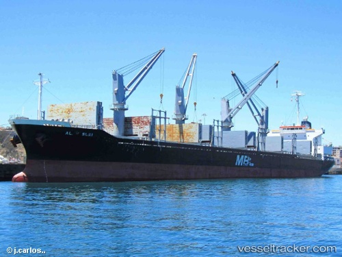
 SAI FORTUNE
Current Status
Where is the vessel?
SAI FORTUNE is currently in 18 nm NW of Mina Khalifa/Abu Dhabi, based on AIS data received less than 1h ago.
Latest AIS update:
Current position: 24.95845° N, 54.36378° E (18 nm NW of Mina Khalifa/Abu Dhabi)
Average speed (last 7 days): Loading…
Average speed (last 30 days): Loading…
Vessel profile: SAI FORTUNE is a Bulk Carrier with dimensions m x m.
This page combines live AIS, route history, probable destination signals, nearby traffic, and port activity for practical vessel monitoring.
The current position of vessel SAI FORTUNE is 24.95845 lat / 54.36378 lng. Updated: 2026-04-10 02:29:04 UTCNearest reference points:
- Near KHALIFA
- 16 nm NW of Jebel Ali
- 11 nm SW of Fateh Terminal
Currently sailing under the flag of Marshall Islands ![]()
Details:
Live Vessel SAI FORTUNE Analytics (details, animations, etc.)
Recent AIS points (UTC):
2026-04-09 19:56:25 UTC · 24.97073, 54.44767 · SOG 5.7 kn · COG 46°2026-04-09 22:12:35 UTC · 24.97206, 54.44714 · SOG 1.3 kn · COG 321°
2026-04-09 23:43:25 UTC · 24.95894, 54.41648 · SOG 1.3 kn · COG 340°
2026-04-10 02:29:04 UTC · 24.95845, 54.36378 · SOG 2 kn · COG 59°