 vesseltracker.com
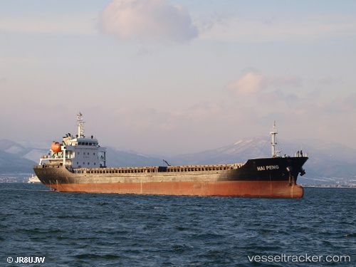
 HAI PENG
Current Status
Where is the vessel?
HAI PENG is currently in 16 nm S of Ha Long, based on AIS data received less than 1h ago.
Latest AIS update:
Current position: 20.70116° N, 107.16999° E (16 nm S of Ha Long)
Average speed (last 7 days): Loading…
Average speed (last 30 days): Loading…
Vessel profile: HAI PENG is a General Cargo with dimensions m x m.
This page combines live AIS, route history, probable destination signals, nearby traffic, and port activity for practical vessel monitoring.
The current position of vessel HAI PENG is 20.70116 lat / 107.16999 lng. Updated: 2026-03-29 03:16:36 UTCNearest reference points:
- 18 nm SE of Ha Long
- 14 nm SE of Nam Hai Dinh Vu Port
- 12 nm SE of Nam Hai Dinh Vu Port
Currently sailing under the flag of Sao Tome and Principe ![]()
Details:
Live Vessel HAI PENG Analytics (details, animations, etc.)
Recent AIS points (UTC):
2026-03-28 20:24:26 UTC · 20.70167, 107.16833 · SOG 0 kn · COG -1°2026-03-28 23:46:32 UTC · 20.70105, 107.16984 · SOG 0.2 kn · COG 59°
2026-03-28 23:52:29 UTC · 20.70103, 107.16984 · SOG 0.1 kn · COG 59°
2026-03-29 03:16:36 UTC · 20.70116, 107.16999 · SOG 0.2 kn · COG 58°