 vesseltracker.com
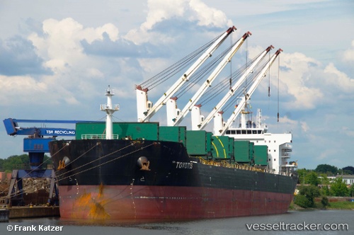
 TOXOTIS
Current Status
Where is the vessel?
TOXOTIS is currently in Near Welcome, based on AIS data received about 2h ago.
Latest AIS update:
Current position: 30.06833° N, 90.89667° W (Near Welcome)
Average speed (last 7 days): Loading…
Average speed (last 30 days): Loading…
Vessel profile: TOXOTIS is a Bulk Carrier with dimensions m x m.
This page combines live AIS, route history, probable destination signals, nearby traffic, and port activity for practical vessel monitoring.
The current position of vessel TOXOTIS is 30.06833 lat / -90.89667 lng. Updated: 2026-03-26 17:45:38 UTCNearest reference points:
- Near Port Of South Louisiana
- Near Brusly
- Near Amelia
Currently sailing under the flag of Liberia ![]()
Details:
Live Vessel TOXOTIS Analytics (details, animations, etc.)
Recent AIS points (UTC):
2026-03-26 11:39:08 UTC · 30.06896, -90.89709 · SOG 0 kn · COG 316°2026-03-26 13:45:08 UTC · 30.06897, -90.89704 · SOG 0 kn · COG 315°
2026-03-26 15:54:40 UTC · 30.06833, -90.89667 · SOG 0 kn · COG -1°
2026-03-26 17:45:38 UTC · 30.06833, -90.89667 · SOG 0 kn · COG -1°