 vesseltracker.com
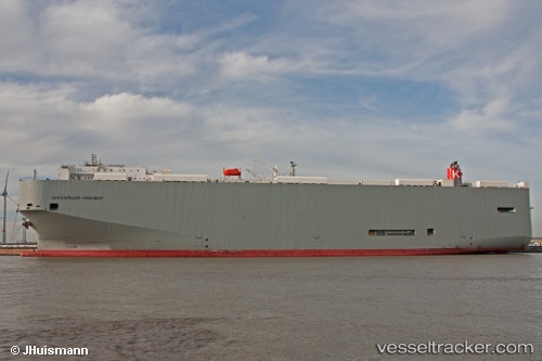
 Chesapeake Highway
Current Status
Where is the vessel?
Chesapeake Highway is currently in Near Yokosuka, based on AIS data received less than 1h ago.
Latest AIS update:
Current position: 35.31766° N, 139.72102° E (Near Yokosuka)
Average speed (last 7 days): Loading…
Average speed (last 30 days): Loading…
Vessel profile: Chesapeake Highway is a Vehicles Carrier with dimensions 200m x 32m.
This page combines live AIS, route history, probable destination signals, nearby traffic, and port activity for practical vessel monitoring.
The current position of vessel Chesapeake Highway is 35.31766 lat / 139.72102 lng. Updated: 2026-03-29 07:38:03 UTCNearest reference points:
- Near Yokosuka
- Near Naka-Ku, Kanagawa
- Near Yokohama
Currently sailing under the flag of Panama ![]()
Chesapeake Highway built in 2010 year
Deadweight:
21643 tDetails:
Live Vessel Chesapeake Highway Analytics (details, animations, etc.)
Recent AIS points (UTC):
2026-03-29 01:30:57 UTC · 35.46141, 139.69722 · SOG 0 kn · COG 59°2026-03-29 03:30:57 UTC · 35.46140, 139.69724 · SOG 0 kn · COG 59°
2026-03-29 05:30:57 UTC · 35.46139, 139.69725 · SOG 0 kn · COG 59°
2026-03-29 07:38:03 UTC · 35.31766, 139.72102 · SOG 12.7 kn · COG 145°