 vesseltracker.com
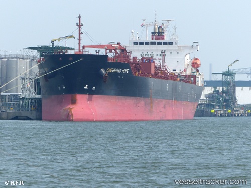
 CHEMROAD HOPE
Current Status
Where is the vessel?
CHEMROAD HOPE is currently in 78 nm W of Coral Bay, based on AIS data received less than 1h ago.
Latest AIS update:
Current position: 22.66375° S, 112.45565° E (78 nm W of Coral Bay)
Average speed (last 7 days): Loading…
Average speed (last 30 days): Loading…
Vessel profile: CHEMROAD HOPE is a Chemical/Oil Products Tanker with dimensions 27m x 170m.
This page combines live AIS, route history, probable destination signals, nearby traffic, and port activity for practical vessel monitoring.
The current position of vessel CHEMROAD HOPE is -22.66375 lat / 112.45565 lng. Updated: 2026-04-02 03:31:08 UTCNearest reference points:
- 139 nm SW of Coral Bay
Currently sailing under the flag of Panama ![]()
CHEMROAD HOPE built in 2011 year
Deadweight:
33552 tDetails:
Live Vessel CHEMROAD HOPE Analytics (details, animations, etc.)
Recent AIS points (UTC):
2026-04-01 22:13:20 UTC · -21.57416, 112.54130 · SOG 12.2 kn · COG 185°2026-04-01 23:49:02 UTC · -21.90209, 112.52069 · SOG 12.2 kn · COG 186°
2026-04-02 02:28:03 UTC · -22.44531, 112.47214 · SOG 12.1 kn · COG 186°
2026-04-02 03:31:08 UTC · -22.66375, 112.45565 · SOG 12.7 kn · COG 186°