 vesseltracker.com
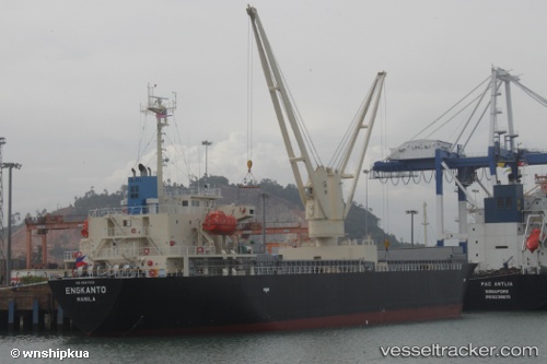
 ENGKANTO
Current Status
Where is the vessel?
ENGKANTO is currently in 85 nm SE of Xijiang, based on AIS data received about 1d ago.
Latest AIS update:
Current position: 20.37167° N, 116.03167° E (85 nm SE of Xijiang)
Average speed (last 7 days): Loading…
Average speed (last 30 days): Loading…
Vessel profile: ENGKANTO is a General Cargo with dimensions m x m.
This page combines live AIS, route history, probable destination signals, nearby traffic, and port activity for practical vessel monitoring.
The current position of vessel ENGKANTO is 20.37167 lat / 116.03167 lng. Updated: 2026-04-10 07:26:37 UTCNearest reference points:
- 148 nm SE of Xijiang
- 49 nm S of SHANWEI
- 53 nm S of Jiazi
Currently sailing under the flag of Panama ![]()
Details:
Live Vessel ENGKANTO Analytics (details, animations, etc.)
Recent AIS points (UTC):
2026-04-10 01:05:39 UTC · 19.38167, 115.41167 · SOG 10 kn · COG -1°2026-04-10 04:01:47 UTC · 19.84163, 115.70101 · SOG 10.7 kn · COG 31°
2026-04-10 05:41:56 UTC · 20.10085, 115.86218 · SOG 10.6 kn · COG 27°
2026-04-10 07:26:37 UTC · 20.37167, 116.03167 · SOG 10 kn · COG -1°