 vesseltracker.com
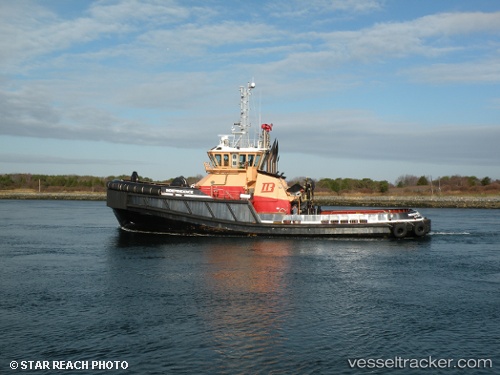
 INDEPENDENCE
Current Status
Where is the vessel?
INDEPENDENCE is currently in Near Boston, based on AIS data received about 2h ago.
Latest AIS update:
Current position: 42.37958° N, 71.04278° W (Near Boston)
Average speed (last 7 days): Loading…
Average speed (last 30 days): Loading…
Vessel profile: INDEPENDENCE is a Tug with dimensions m x m.
This page combines live AIS, route history, probable destination signals, nearby traffic, and port activity for practical vessel monitoring.
The current position of vessel INDEPENDENCE is 42.37958 lat / -71.04278 lng. Updated: 2026-03-27 15:29:55 UTCNearest reference points:
- Near Cohasset
- Near East Providence
- Near Kittery
Currently sailing under the flag of United States ![]()
Details:
Live Vessel INDEPENDENCE Analytics (details, animations, etc.)
Recent AIS points (UTC):
2026-03-27 09:42:06 UTC · 42.37957, -71.04277 · SOG 0 kn · COG 88°2026-03-27 11:58:05 UTC · 42.37958, -71.04270 · SOG 0 kn · COG 83°
2026-03-27 13:28:34 UTC · 42.37958, -71.04276 · SOG 0 kn · COG 84°
2026-03-27 15:29:55 UTC · 42.37958, -71.04278 · SOG 0 kn · COG 83°