.
Vessel photo of KITSOS (IMO 9568809) vesseltracker.com

LB flag KITSOS

Vessel type: Crude Oil Tanker | IMO: 9568809 | MMSI: MMSI: 636021032
Call sign: 5LBX5 | Dimensions: 333 m x 60 m
Current Status

Where is the vessel?

KITSOS is currently in 68 nm W of Terempa, based on AIS data received less than 1h ago.

Latest AIS update:

Current position: 2.81545° N, 105.15723° E (68 nm W of Terempa)

Average speed (last 7 days): Loading…

Average speed (last 30 days): Loading…

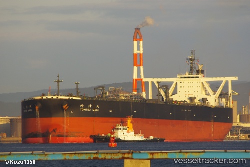
Vessel profile: KITSOS is a Crude Oil Tanker with dimensions 333m x 60m.

This page combines live AIS, route history, probable destination signals, nearby traffic, and port activity for practical vessel monitoring.

The current position of vessel KITSOS is 2.81545 lat / 105.15723 lng. Updated: 2026-04-04 01:38:00 UTC
Nearest reference points:
  • 80 nm SW of Terempa
  • 64 nm NE of PENGERANG
  • 53 nm NE of PENGERANG

Currently sailing under the flag of Liberia LB flag

KITSOS built in 2011 year

Deadweight:
305484 t

Details:

Live Vessel KITSOS Analytics (details, animations, etc.)


Recent AIS points (UTC):
2026-04-03 19:41:30 UTC · 1.73122, 104.81815 · SOG 11.4 kn · COG 22°
2026-04-03 22:13:49 UTC · 2.18298, 105.00172 · SOG 11.5 kn · COG 32°
2026-04-04 00:00:38 UTC · 2.51923, 105.07683 · SOG 11.4 kn · COG 22°
2026-04-04 01:38:00 UTC · 2.81545, 105.15723 · SOG 11.1 kn · COG 36°

Track of the vessel in the last 60 days


UTC: --
Start: -- Track timeline (UTC) End: --
Encountered: --


Link to the map:


Find another ship

KITSOS (636021032) last ports (portcalls and passsages)

Mai-Liai | 2025-09-08 11:08:51
TANAH MERAH | 2025-09-01 22:28:07
BATU AMPAR | 2025-09-01 21:57:45
PULAU SAMBU | 2025-09-01 21:25:14
BUKOM ISLAND | 2025-05-23 09:55:39
PULAU SAMBU | 2025-05-22 10:17:17
BUKOM ISLAND | 2025-05-19 07:24:13
JURONG ISLAND | 2025-05-19 06:24:57
Das Island | 2025-05-02 20:41:52
Az Zarqa Island | 2025-05-01 18:59:34
Fateh Terminal | 2025-05-01 04:22:39
PULAU SAMBU | 2025-04-13 15:47:20
Singapore | 2025-04-12 23:48:57
TANAH MERAH | 2025-04-12 22:23:45
PENGERANG | 2025-04-12 20:05:45
PENGERANG | 2025-03-18 04:42:17
TANAH MERAH | 2025-03-18 03:43:50
PULAU SAMBU | 2025-03-18 03:06:32
BUKOM ISLAND | 2025-02-11 00:08:14
TANAH MERAH | 2025-02-10 07:18:04
PENGERANG | 2025-02-10 05:50:22
Shiogama | 2025-01-30 00:58:49
SENDAI | 2025-01-29 07:58:29
Kiire | 2025-01-25 02:03:51
YAMAGAWA | 2025-01-24 23:29:21
PENGERANG | 2025-01-15 19:13:24
BATU AMPAR | 2025-01-15 17:35:46
PULAU SAMBU | 2025-01-15 16:47:20
Ras Tannurah | 2024-12-30 11:04:25
Fateh Terminal | 2024-12-28 07:27:47
PULAU SAMBU | 2024-12-12 23:28:29
BATU AMPAR | 2024-12-12 22:53:53
TANAH MERAH | 2024-12-12 06:34:06
PENGERANG | 2024-12-12 04:05:51
PENGERANG | 2024-11-27 13:18:50
TANAH MERAH | 2024-11-27 11:55:02
BATU AMPAR | 2024-11-27 11:08:22
Ras Tannurah | 2024-11-10 22:28:09
Galle | 2024-10-31 00:24:57
Singapore | 2024-10-25 10:27:14
Singapore | 2024-10-05 03:42:01
Singapore | 2024-08-13 21:13:36
Mutrah | 2024-07-30 16:29:40
Sambu | 2024-07-14 00:27:25
Singapore | 2024-07-13 05:01:19
Singapore | 2024-06-24 11:41:17
Yokosuka | 2024-05-06 02:59:42
Kawasaki | 2024-05-06 01:58:45
Chibai | 2024-05-05 01:59:03
Honshu | 2024-05-03 07:58:48
Chibai | 2024-04-26 05:58:16
Kawasaki | 2024-04-26 04:58:14
Yokosuka | 2024-04-26 04:18:10
Fujairah | 2024-04-01 16:44:08
Singapore | 2024-03-22 01:22:52
Das Island | 2024-03-04 08:29:13
Az Zarqa Island | 2024-03-02 19:47:50
Az Zarqa Island | 2023-09-25 20:09:48
Ayn Sukhnah | 2023-09-04 21:44:24
Ayn Sukhnah | 2023-08-31 21:12:08
Ayn Sukhnah | 2023-08-27 20:53:55
Ayn Sukhnah | 2023-08-23 20:48:29
Ayn Sukhnah | 2023-08-19 20:12:46
Ayn Sukhnah | 2023-08-15 19:20:16
Ra’S Shukhayr | 2023-08-15 08:23:51
Sambu | 2023-07-09 21:58:16
Sambu | 2023-06-17 10:18:48
Az Zarqa Island | 2023-04-19 07:26:05
Ras Tannurah | 2023-04-16 16:17:27
Ras Tannurah | 2023-03-06 08:14:42
Singapore | 2023-02-13 20:13:41