 vesseltracker.com
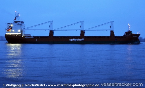
 Maasgracht
Current Status
Where is the vessel?
Maasgracht is currently in 47 nm SE of Udang Natuna Terminal, based on AIS data received less than 1h ago.
Latest AIS update:
Current position: 3.50500° N, 107.06167° E (47 nm SE of Udang Natuna Terminal)
Average speed (last 7 days): Loading…
Average speed (last 30 days): Loading…
Vessel profile: Maasgracht is a General Cargo Ship with dimensions 142m x 19m.
This page combines live AIS, route history, probable destination signals, nearby traffic, and port activity for practical vessel monitoring.
The current position of vessel Maasgracht is 3.50500 lat / 107.06167 lng. Updated: 2026-04-01 15:42:20 UTCNearest reference points:
- 45 nm E of Terempa
- 30 nm SW of Belanak Terminal
- 45 nm E of Kakap Natuna Terminal
Currently sailing under the flag of Netherlands ![]()
Maasgracht built in 2011 year
Deadweight:
11759 tDetails:
Live Vessel Maasgracht Analytics (details, animations, etc.)
Recent AIS points (UTC):
2026-04-01 09:18:22 UTC · 2.33666, 106.86500 · SOG 11 kn · COG -1°2026-04-01 11:39:21 UTC · 2.76833, 106.92333 · SOG 10 kn · COG -1°
2026-04-01 13:36:20 UTC · 3.12167, 106.98500 · SOG 11 kn · COG -1°
2026-04-01 15:42:20 UTC · 3.50500, 107.06167 · SOG 10 kn · COG -1°