 vesseltracker.com
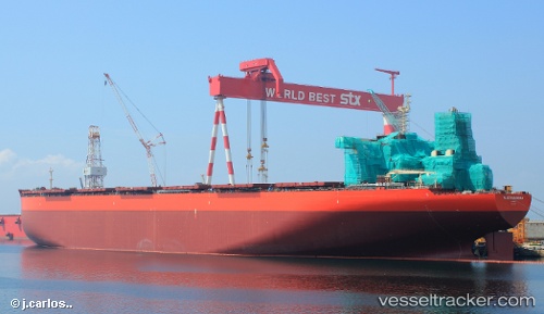
 SEA MARANHAO
Current Status
Where is the vessel?
SEA MARANHAO is currently in 20 nm SE of DONGJIAKOU, based on AIS data received about 1h ago.
Latest AIS update:
Current position: 35.35068° N, 120.08374° E (20 nm SE of DONGJIAKOU)
Average speed (last 7 days): Loading…
Average speed (last 30 days): Loading…
Vessel profile: SEA MARANHAO is a Ore Carrier with dimensions 65m x 361m.
This page combines live AIS, route history, probable destination signals, nearby traffic, and port activity for practical vessel monitoring.
The current position of vessel SEA MARANHAO is 35.35068 lat / 120.08374 lng. Updated: 2026-04-04 07:53:26 UTCNearest reference points:
- 24 nm SE of DONGJIAKOU
- 25 nm SE of DONGJIAKOU
- 14 nm S of DONGJIAKOU
Currently sailing under the flag of Marshall Islands ![]()
SEA MARANHAO built in 2013 year
Deadweight:
403844 tDetails:
Live Vessel SEA MARANHAO Analytics (details, animations, etc.)
Recent AIS points (UTC):
2026-04-04 02:08:26 UTC · 35.35175, 120.09149 · SOG 0.2 kn · COG 283°2026-04-04 04:17:27 UTC · 35.35321, 120.09087 · SOG 0.1 kn · COG 253°
2026-04-04 05:41:27 UTC · 35.35383, 120.08957 · SOG 0.1 kn · COG 229°
2026-04-04 07:53:26 UTC · 35.35068, 120.08374 · SOG 0 kn · COG 72°