 vesseltracker.com
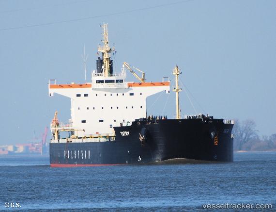
 Tatry
Tatry
Current Status
Where is the vessel?
Tatry is currently in 70 nm NE of Ust-Kamchatsk, based on AIS data received about 3h ago.
Latest AIS update:
Current position: 50.98308° N, 164.03894° E (70 nm NE of Ust-Kamchatsk)
Average speed (last 7 days): Loading…
Average speed (last 30 days): Loading…
Vessel profile: Tatry is a Bulk Carrier with dimensions 229m x 32m.
This page combines live AIS, route history, probable destination signals, nearby traffic, and port activity for practical vessel monitoring.
The current position of vessel Tatry is 50.98308 lat / 164.03894 lng. Updated: 2026-03-27 09:35:50 UTCCurrently sailing under the flag of Liberia ![]()
Tatry built in 2013 year
Deadweight:
82138 tDetails:
Live Vessel Tatry Analytics (details, animations, etc.)
Recent AIS points (UTC):
2026-03-27 03:27:21 UTC · 51.56517, 165.54767 · SOG 10.2 kn · COG 238°2026-03-27 06:18:24 UTC · 51.30141, 164.85927 · SOG 10.9 kn · COG 240°
2026-03-27 07:59:57 UTC · 51.13667, 164.43500 · SOG 11 kn · COG -1°
2026-03-27 09:35:50 UTC · 50.98308, 164.03894 · SOG 10.9 kn · COG 232°