 vesseltracker.com
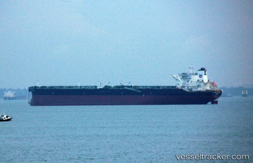
 ALMI HYDRA
Current Status
Where is the vessel?
ALMI HYDRA is currently in 30 nm N of Ras Tannurah, based on AIS data received less than 1h ago.
Latest AIS update:
Current position: 27.13585° N, 50.25258° E (30 nm N of Ras Tannurah)
Average speed (last 7 days): Loading…
Average speed (last 30 days): Loading…
Vessel profile: ALMI HYDRA is a Crude Oil Tanker with dimensions 60m x 333m.
This page combines live AIS, route history, probable destination signals, nearby traffic, and port activity for practical vessel monitoring.
The current position of vessel ALMI HYDRA is 27.13585 lat / 50.25258 lng. Updated: 2026-04-02 06:00:22 UTCNearest reference points:
- 13 nm NE of AL JUBAIL
- Near Al Jubayl
- Near DAMMAM
Currently sailing under the flag of Liberia ![]()
ALMI HYDRA built in 2013 year
Deadweight:
319357 tDetails:
Live Vessel ALMI HYDRA Analytics (details, animations, etc.)
Recent AIS points (UTC):
2026-04-01 23:45:59 UTC · 27.13577, 50.25576 · SOG 0 kn · COG -1°2026-04-02 01:32:02 UTC · 27.13549, 50.25489 · SOG 0 kn · COG -1°
2026-04-02 04:00:11 UTC · 27.13545, 50.25339 · SOG 0 kn · COG -1°
2026-04-02 06:00:22 UTC · 27.13585, 50.25258 · SOG 0 kn · COG -1°