 vesseltracker.com
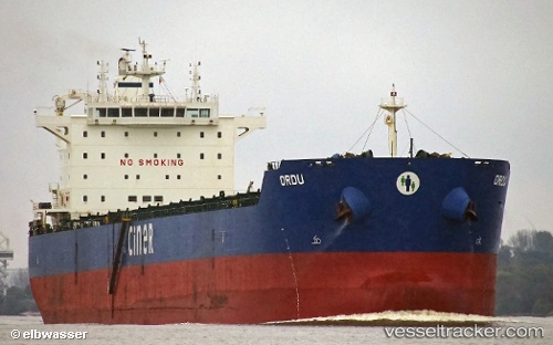
 Ordu
Ordu
Current Status
Where is the vessel?
Ordu is currently in 375 nm E of Windermere, based on AIS data received about 4h ago.
Latest AIS update:
Current position: 33.96430° S, 10.97940° W (375 nm E of Windermere)
Average speed (last 7 days): Loading…
Average speed (last 30 days): Loading…
Vessel profile: Ordu is a Bulk Carrier with dimensions 229m x 229m.
This page combines live AIS, route history, probable destination signals, nearby traffic, and port activity for practical vessel monitoring.
The current position of vessel Ordu is -33.9643 lat / -10.9794 lng. Updated: 2026-04-05 00:37:49 UTCNearest reference points:
- Open sea (no nearby ports in database)
- Open sea, approx. 401 nm off the nearest listed port
- Open sea, approx. 403 nm off the nearest listed port
Currently sailing under the flag of Malta ![]()
Ordu built in 2012 year
Deadweight:
81950 tDetails:
Live Vessel Ordu Analytics (details, animations, etc.)
Recent AIS points (UTC):
2026-04-04 19:34:28 UTC · -33.81390, -11.93870 · SOG 9.4 kn · COG 101°2026-04-04 21:09:06 UTC · -33.85770, -11.64150 · SOG 9.8 kn · COG 101°
2026-04-04 23:43:28 UTC · -33.93850, -11.14980 · SOG 9.6 kn · COG 103°
2026-04-05 00:37:49 UTC · -33.96430, -10.97940 · SOG 9.4 kn · COG 103°