 vesseltracker.com
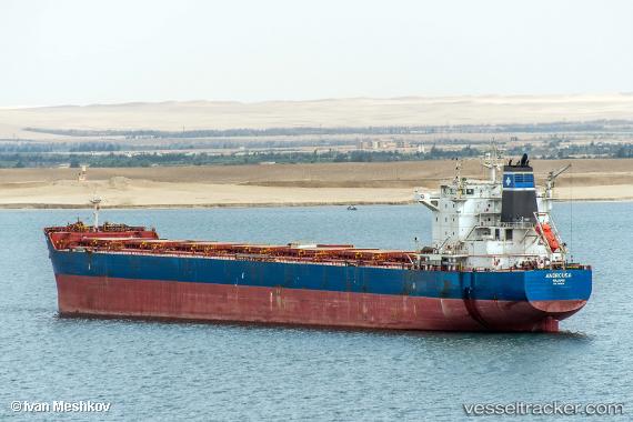
 Androusa
Current Status
Where is the vessel?
Androusa is currently in 292 nm E of Kings Bromley, based on AIS data received about 3h ago.
Latest AIS update:
Current position: 51.89453° N, 141.15858° W (292 nm E of Kings Bromley)
Average speed (last 7 days): Loading…
Average speed (last 30 days): Loading…
Vessel profile: Androusa is a Bulk Carrier with dimensions 229m x 32m.
This page combines live AIS, route history, probable destination signals, nearby traffic, and port activity for practical vessel monitoring.
The current position of vessel Androusa is 51.89453 lat / -141.15858 lng. Updated: 2026-03-28 03:14:06 UTCCurrently sailing under the flag of Marshall Is ![]()
Androusa built in 2012 year
Deadweight:
81533 tDetails:
Live Vessel Androusa Analytics (details, animations, etc.)
Recent AIS points (UTC):
2026-03-27 21:30:36 UTC · 51.38287, -139.83652 · SOG 10 kn · COG 299°2026-03-27 23:31:06 UTC · 51.55893, -140.29105 · SOG 10.2 kn · COG 300°
2026-03-28 02:18:36 UTC · 51.81038, -140.94048 · SOG 10.3 kn · COG 301°
2026-03-28 03:14:06 UTC · 51.89453, -141.15858 · SOG 10.3 kn · COG 300°