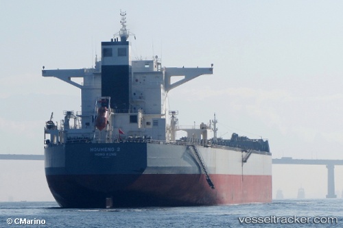
.
Vessel photo of NN TENACITY (IMO 9586801) vesseltracker.com

LB flag NN TENACITY

Vessel type: Bulk Carrier | IMO: 9586801 | MMSI: MMSI: 636020997
Call sign: 5LBS8 | Dimensions: 292 m x 292 m
Current Status

Where is the vessel?

NN TENACITY is currently in 16 nm W of PORT DICKSON, based on AIS data received less than 1h ago.

Latest AIS update:

Current position: 2.47358° N, 101.52511° E (16 nm W of PORT DICKSON)

Average speed (last 7 days): Loading…

Average speed (last 30 days): Loading…

Vessel profile: NN TENACITY is a Bulk Carrier with dimensions 292m x 292m.

This page combines live AIS, route history, probable destination signals, nearby traffic, and port activity for practical vessel monitoring.

The current position of vessel NN TENACITY is 2.47358 lat / 101.52511 lng. Updated: 2026-04-04 08:06:47 UTC
Nearest reference points:
  • 13 nm SW of PORT DICKSON
  • Near PORT DICKSON
  • 14 nm SW of Banting

Currently sailing under the flag of Liberia LB flag

NN TENACITY built in 2011 year

Deadweight:
179929 t

Details:

Live Vessel NN TENACITY Analytics (details, animations, etc.)


Recent AIS points (UTC):
2026-04-04 00:56:28 UTC · 3.04480, 100.60750 · SOG 9.5 kn · COG 136°
2026-04-04 02:56:37 UTC · 2.85526, 100.84760 · SOG 9 kn · COG 122°
2026-04-04 06:12:18 UTC · 2.63774, 101.28513 · SOG 8.9 kn · COG 121°
2026-04-04 08:06:47 UTC · 2.47358, 101.52511 · SOG 9.5 kn · COG 127°

Track of the vessel in the last 60 days


UTC: --
Start: -- Track timeline (UTC) End: --
Encountered: --


Link to the map:


Find another ship

NN_TENACITY (636020997) last ports (portcalls and passsages)

Mai-Liai | 2025-09-14 11:55:26
Newcastle | 2025-08-24 03:48:42
CHANGXINDAO | 2025-07-25 08:29:38
CHANGXINDAO | 2025-07-12 07:01:41
CHANGXINDAO | 2025-07-04 20:15:12
CHANGXINDAO | 2025-06-26 06:36:04
CHANGXINDAO | 2025-06-15 16:51:08
CHANGXINDAO | 2025-06-05 07:00:43
CHANGXINDAO | 2025-05-25 07:01:34
CHANGXINDAO | 2025-05-09 10:20:26
CHANGXINDAO | 2025-05-05 04:25:22
Qingdao | 2025-04-28 08:25:37
TANAH MERAH | 2025-04-14 14:59:29
BATU AMPAR | 2025-04-14 13:09:49
Singapore | 2025-04-14 11:49:40
PULAU SAMBU | 2025-04-14 10:53:04
BATU AMPAR | 2025-01-25 15:35:42
TANAH MERAH | 2025-01-25 03:46:23
TANAH MERAH | 2025-01-21 02:57:10
PENGERANG | 2025-01-20 23:53:13
Fangcheng | 2025-01-11 19:36:57
PENGERANG | 2025-01-04 00:26:36
TANAH MERAH | 2025-01-03 11:00:13
PULAU SAMBU | 2025-01-03 08:41:45
ITAGUAI | 2024-11-21 10:14:15
MANGARATIBA | 2024-11-21 08:34:32
Sambu | 2024-10-11 02:12:39
Singapore | 2024-10-10 19:37:18
Singapore | 2024-10-06 13:15:10
Singapore | 2024-10-02 12:56:29
Singapore | 2024-09-28 12:20:52
Dagu Bar | 2024-09-07 10:15:51
Taku Bar | 2024-09-05 06:21:01
Singapore | 2024-08-19 18:34:27
Sao Luiz | 2024-07-09 23:10:01
Ponta da Madeira | 2024-07-08 18:45:52
Sao Luiz | 2024-07-05 22:54:13
Sao Luiz | 2024-07-01 22:53:01
Sao Luiz | 2024-06-27 21:50:16
Sambu | 2024-05-22 06:36:33
Wusong | 2024-05-09 17:48:47
Taixing | 2024-05-07 01:50:01
Zhangjiagang | 2024-05-06 10:46:13
Nantong | 2024-05-06 08:07:39
Taicang | 2024-05-06 05:15:43
Jingjiang | 2024-05-05 21:35:14
Selat Lombok | 2024-04-20 09:38:53
Singapore | 2024-02-09 03:09:02
Richards Bay | 2024-01-19 12:59:12
Singapore | 2023-12-02 05:53:33
Saldanha Bay | 2023-11-05 07:22:50
Saldanha Bay | 2023-10-29 17:38:59
Singapore | 2023-10-09 03:19:43
Fangcheng | 2023-09-29 09:54:01
Singapore | 2023-09-21 05:56:37
Ponta da Madeira | 2023-08-08 01:25:17
Sambu | 2023-06-27 10:05:07
Singapore | 2023-06-26 16:36:30
Algeciras | 2023-03-23 11:02:03
Canakkale | 2023-03-17 05:18:51
Uskudar | 2023-03-08 08:47:03
Strait Of Gibraltar | 2023-02-24 21:11:09
Algeciras | 2023-01-13 11:49:21
Singapore | 2022-11-24 20:05:06
Singapore | 2022-11-10 23:54:15
Singapore | 2022-09-22 22:53:59
Singapore | 2022-07-19 10:19:45
La Spezia | 2022-07-02 16:17:17
Singapore | 2022-04-09 23:49:46
La Spezia | 2021-12-15 10:12:47