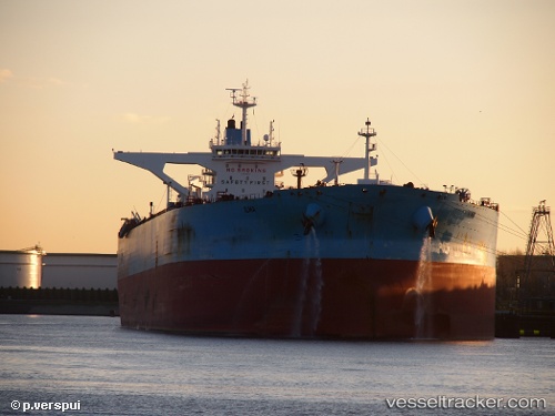
.
Vessel photo of Ilma (IMO 9588392) vesseltracker.com

BE flag Ilma

Vessel type: Crude Oil Tanker | IMO: 9588392 | MMSI: MMSI: 205657000
Call sign: ONHX | Dimensions: 333 m x 60 m
Current Status

Where is the vessel?

Ilma is currently in 79 nm NE of Lü-hua Shan, based on AIS data received less than 1h ago.

Latest AIS update:

Current position: 31.31308° N, 124.03007° E (79 nm NE of Lü-hua Shan)

Average speed (last 7 days): Loading…

Average speed (last 30 days): Loading…

Vessel profile: Ilma is a Crude Oil Tanker with dimensions 333m x 60m.

This page combines live AIS, route history, probable destination signals, nearby traffic, and port activity for practical vessel monitoring.

The current position of vessel Ilma is 31.31308 lat / 124.03007 lng. Updated: 2026-03-31 02:01:45 UTC
Nearest reference points:
  • 97 nm E of Lü-hua Shan
  • 70 nm NE of Jingjiang
  • 44 nm E of Lü-hua Shan

Currently sailing under the flag of Belgium BE flag

Ilma built in 2012 year

Deadweight:
318477 t

Details:

Live Vessel Ilma Analytics (details, animations, etc.)


Recent AIS points (UTC):
2026-03-30 20:07:53 UTC · 30.29201, 123.70007 · SOG 11.3 kn · COG 65°
2026-03-30 20:26:53 UTC · 30.31173, 123.76566 · SOG 11 kn · COG 65°
2026-03-30 23:37:15 UTC · 30.80800, 123.97083 · SOG 12.1 kn · COG -1°
2026-03-31 02:01:45 UTC · 31.31308, 124.03007 · SOG 12.3 kn · COG -1°

Track of the vessel in the last 28 days


UTC: --
Start: -- Track timeline (UTC) End: --
Encountered: --


Link to the map:


Find another ship

Ilma (205657000) last ports (portcalls and passsages)

PENGERANG | 2025-09-14 11:41:22
SULTAN QABOOS | 2025-08-29 11:46:02
MINA AL FAHL | 2025-08-29 09:55:45
Az Zarqa Island | 2025-08-23 19:43:31
Galle | 2025-08-10 18:50:12
Singapore | 2025-08-05 05:23:23
BATU AMPAR | 2025-08-05 04:57:44
TANAH MERAH | 2025-08-03 17:05:59
PENGERANG | 2025-08-03 15:52:59
PENGERANG | 2025-07-06 12:02:01
TANAH MERAH | 2025-07-06 01:22:23
BATU AMPAR | 2025-07-05 23:47:59
PULAU SAMBU | 2025-07-05 23:24:02
BUKOM ISLAND | 2025-07-05 22:04:47
ASALUYEH | 2025-06-22 19:49:41
Das Island | 2025-06-22 11:02:42
Assaluyeh | 2025-06-22 05:51:18
Az Zarqa Island | 2025-06-20 22:05:57
PULAU SAMBU | 2025-05-27 13:20:40
Singapore | 2025-05-26 20:53:25
TANAH MERAH | 2025-05-26 18:47:58
PENGERANG | 2025-05-26 18:17:37
LANSHAN | 2025-05-15 04:35:47
ZHOUSHAN | 2025-05-10 05:58:55
BAKAUHENI | 2025-04-29 17:25:03
PULAU SAMBU | 2025-03-04 09:21:38
TANAH MERAH | 2025-03-02 13:15:38
PENGERANG | 2025-03-02 11:43:03
Taku Bar | 2025-02-21 05:17:45
Dagu Bar | 2025-02-18 03:19:06
Qingdao | 2025-02-15 03:11:00
PENGERANG | 2025-02-04 11:32:20
TANAH MERAH | 2025-02-04 09:25:41
BUKOM ISLAND | 2025-02-04 07:49:56
BUKOM ISLAND | 2024-12-04 01:28:41
BATU AMPAR | 2024-12-04 00:23:17
TANAH MERAH | 2024-12-02 19:26:55
PENGERANG | 2024-12-02 18:14:59
Incheon | 2024-11-23 00:36:06
ONSAN | 2024-11-15 01:59:16
Maassluis | 2024-08-24 17:21:54
Algeciras | 2024-08-18 09:48:58
Strait Of Gibraltar | 2024-08-17 02:04:24
Angra Dos Reis | 2024-07-30 09:27:51
Port Louis | 2024-07-03 23:22:35
Sambu | 2024-06-22 13:37:57
Puerto Armuelles | 2024-05-01 14:05:09
Los Angeles | 2024-04-17 19:06:08
Sambu | 2024-03-10 17:34:22
Fateh Terminal | 2024-02-27 17:46:45
Fateh Terminal | 2024-02-19 21:20:29
Singapore | 2024-02-09 00:38:52
Sambu | 2024-01-23 16:10:27
Singapore | 2023-12-16 10:39:32
Sambu | 2023-12-16 10:18:16
Puerto Armuelles | 2023-10-25 19:51:54
Los Angeles | 2023-10-15 03:39:51
Ras Tannurah | 2023-05-31 21:31:57
Singapore | 2023-05-19 08:23:57
Limetree Bay | 2023-03-26 13:24:41
Limetree Bay | 2023-03-22 11:45:23
Limetree Bay | 2023-03-18 11:37:00
Maassluis | 2023-02-28 08:08:49
Algeciras | 2023-02-22 18:05:04
Sambu | 2023-01-07 08:34:30
Singapore | 2022-11-11 17:43:40
Ulsan | 2022-10-31 08:22:48
Ras Tannurah | 2022-09-29 01:52:04
Maassluis | 2022-03-09 21:00:26
Port Said | 2022-02-09 16:15:52
Bur Ibrahim | 2022-02-09 06:05:11
Ra’S Shukhayr | 2022-02-08 00:05:00
Mutrah | 2022-01-02 23:00:29
Singapore | 2021-12-12 22:37:12
Sambu | 2021-12-12 21:30:57