 vesseltracker.com
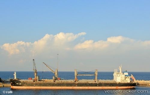
 NIKOS
NIKOS
Current Status
Where is the vessel?
NIKOS is currently in Near Tamatave, based on AIS data received about 2h ago.
Latest AIS update:
Current position: 18.15543° S, 49.42429° E (Near Tamatave)
Average speed (last 7 days): Loading…
Average speed (last 30 days): Loading…
Vessel profile: NIKOS is a Bulk Carrier with dimensions m x m.
This page combines live AIS, route history, probable destination signals, nearby traffic, and port activity for practical vessel monitoring.
The current position of vessel NIKOS is -18.15543 lat / 49.42429 lng. Updated: 2026-04-02 01:37:20 UTCCurrently sailing under the flag of Liberia ![]()
Details:
Live Vessel NIKOS Analytics (details, animations, etc.)
Recent AIS points (UTC):
2026-04-01 19:42:37 UTC · -18.08988, 49.41674 · SOG 0.1 kn · COG 22°2026-04-01 21:55:33 UTC · -18.15311, 49.42293 · SOG 0.8 kn · COG 155°
2026-04-01 23:46:18 UTC · -18.15548, 49.42434 · SOG 0 kn · COG 170°
2026-04-02 01:37:20 UTC · -18.15543, 49.42429 · SOG 0 kn · COG 170°