 vesseltracker.com
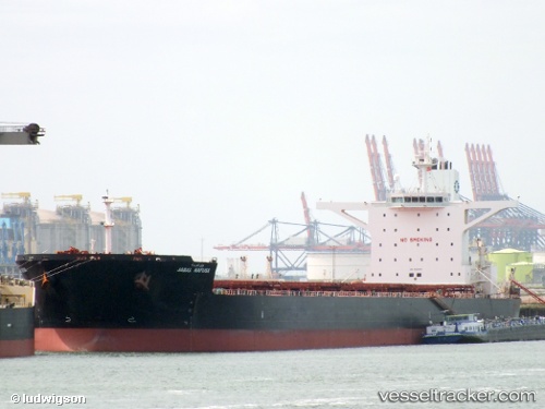
 PANTARISTE
Current Status
Where is the vessel?
PANTARISTE is currently in Near Port Walcot, based on AIS data received about 1h ago.
Latest AIS update:
Current position: 20.51845° S, 117.30650° E (Near Port Walcot)
Average speed (last 7 days): Loading…
Average speed (last 30 days): Loading…
Vessel profile: PANTARISTE is a Bulk Carrier with dimensions 45m x 290m.
This page combines live AIS, route history, probable destination signals, nearby traffic, and port activity for practical vessel monitoring.
The current position of vessel PANTARISTE is -20.51845 lat / 117.30650 lng. Updated: 2026-03-29 09:38:39 UTCNearest reference points:
- 11 nm E of Port Walcot
- 116 nm NE of Mutineer
Currently sailing under the flag of Liberia ![]()
PANTARISTE built in 2011 year
Deadweight:
169097 tDetails:
Live Vessel PANTARISTE Analytics (details, animations, etc.)
Recent AIS points (UTC):
2026-03-29 03:30:35 UTC · -20.51548, 117.30691 · SOG 0 kn · COG -1°2026-03-29 05:45:13 UTC · -20.51554, 117.30701 · SOG 0.1 kn · COG -1°
2026-03-29 07:40:59 UTC · -20.51797, 117.30683 · SOG 0.1 kn · COG -1°
2026-03-29 09:38:39 UTC · -20.51845, 117.30650 · SOG 0 kn · COG 318°