 vesseltracker.com
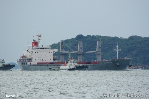
 GHANTOUT
Current Status
Where is the vessel?
GHANTOUT is currently in 26 nm SW of Fateh Terminal, based on AIS data received about 1h ago.
Latest AIS update:
Current position: 25.26820° N, 54.21273° E (26 nm SW of Fateh Terminal)
Average speed (last 7 days): Loading…
Average speed (last 30 days): Loading…
Vessel profile: GHANTOUT is a Bulk Carrier with dimensions 25m x 154m.
This page combines live AIS, route history, probable destination signals, nearby traffic, and port activity for practical vessel monitoring.
The current position of vessel GHANTOUT is 25.26820 lat / 54.21273 lng. Updated: 2026-03-31 15:04:49 UTCNearest reference points:
- 11 nm SW of Fateh Terminal
- 16 nm NW of Jebel Ali
- Near KHALIFA
Currently sailing under the flag of United Arab Emirates ![]()
GHANTOUT built in 2011 year
Deadweight:
23186 tDetails:
Live Vessel GHANTOUT Analytics (details, animations, etc.)
Recent AIS points (UTC):
2026-03-31 08:55:54 UTC · 25.08282, 54.56090 · SOG 0.1 kn · COG -1°2026-03-31 08:55:54 UTC · 25.08282, 54.56090 · SOG 0.1 kn · COG -1°
2026-03-31 13:42:07 UTC · 25.30523, 54.21459 · SOG 48.5 kn · COG 36°
2026-03-31 15:04:49 UTC · 25.26820, 54.21273 · SOG 48.4 kn · COG -1°