 vesseltracker.com
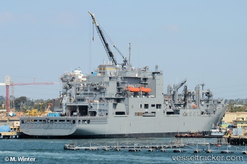
Us Gov Vessel
Current StatusWhere is the vessel?
Us Gov Vessel is currently in 69 nm SW of Taniyama, based on AIS data received about 1h ago.
Latest AIS update:
Current position: 30.72667° N, 129.15500° E (69 nm SW of Taniyama)
Average speed (last 7 days): Loading…
Average speed (last 30 days): Loading…
Vessel profile: Us Gov Vessel is a General Cargo Ship with dimensions 32m x 210m.
This page combines live AIS, route history, probable destination signals, nearby traffic, and port activity for practical vessel monitoring.
The current position of vessel Us Gov Vessel is 30.72667 lat / 129.15500 lng. Updated: 2026-04-07 11:28:28 UTCNearest reference points:
- 71 nm SW of Taniyama
- Near YAMAGAWA
- Near Kiire
Details:
Live Vessel Us Gov Vessel Analytics (details, animations, etc.)
Recent AIS points (UTC):
2026-04-07 05:54:30 UTC · 31.65500, 128.20166 · SOG 13 kn · COG -1°2026-04-07 06:42:44 UTC · 31.51500, 128.33501 · SOG 13 kn · COG -1°
2026-04-07 09:22:05 UTC · 31.07833, 128.79500 · SOG 14 kn · COG -1°
2026-04-07 11:28:28 UTC · 30.72667, 129.15500 · SOG 13 kn · COG -1°