 vesseltracker.com
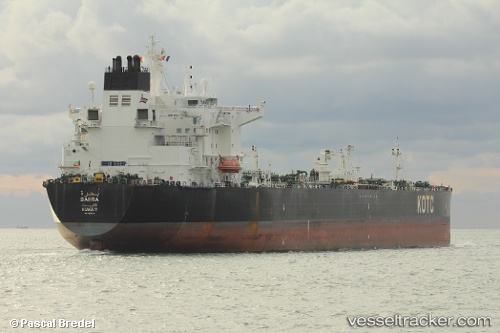
 Bahra
Bahra
Current Status
Where is the vessel?
Bahra is currently in 153 nm SW of Okha, based on AIS data received less than 1h ago.
Latest AIS update:
Current position: 20.75579° N, 67.07146° E (153 nm SW of Okha)
Average speed (last 7 days): Loading…
Average speed (last 30 days): Loading…
Vessel profile: Bahra is a Crude Oil Tanker with dimensions 249m x 42m.
This page combines live AIS, route history, probable destination signals, nearby traffic, and port activity for practical vessel monitoring.
The current position of vessel Bahra is 20.75579 lat / 67.07146 lng. Updated: 2026-04-02 23:41:37 UTCNearest reference points:
- 231 nm SW of Keti Bandar
- 54 nm S of Positra
- 49 nm S of Positra
Currently sailing under the flag of Kuwait ![]()
Bahra built in 2012 year
Deadweight:
110761 tDetails:
Live Vessel Bahra Analytics (details, animations, etc.)
Recent AIS points (UTC):
2026-04-02 18:06:54 UTC · 20.92313, 66.88297 · SOG 3 kn · COG 151°2026-04-02 20:10:35 UTC · 20.86394, 66.96554 · SOG 2.8 kn · COG 148°
2026-04-02 21:20:34 UTC · 20.82685, 67.00547 · SOG 2.5 kn · COG 145°
2026-04-02 23:41:37 UTC · 20.75579, 67.07146 · SOG 2.3 kn · COG -1°