 vesseltracker.com
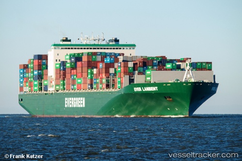
Ever Lambent
Current StatusWhere is the vessel?
Ever Lambent is currently in 321 nm NE of Isla de Pascua, based on AIS data received about 1h ago.
Latest AIS update:
Current position: 22.95273° S, 105.76345° W (321 nm NE of Isla de Pascua)
Average speed (last 7 days): Loading…
Average speed (last 30 days): Loading…
Vessel profile: Ever Lambent is a Container Ship with dimensions 46m x 335m.
This page combines live AIS, route history, probable destination signals, nearby traffic, and port activity for practical vessel monitoring.
The current position of vessel Ever Lambent is -22.95273 lat / -105.76345 lng. Updated: 2026-04-13 13:44:19 UTCNearest reference points:
- Open sea, approx. 404 nm off the nearest listed port
- Open sea, approx. 405 nm off the nearest listed port
- Open sea, approx. 420 nm off the nearest listed port
Details:
Live Vessel Ever Lambent Analytics (details, animations, etc.)
Recent AIS points (UTC):
2026-04-13 07:41:25 UTC · -22.95894, -104.20822 · SOG 14.2 kn · COG 270°2026-04-13 09:35:00 UTC · -22.95676, -104.69442 · SOG 14.3 kn · COG 270°
2026-04-13 11:23:06 UTC · -22.95671, -105.15901 · SOG 14.4 kn · COG 270°
2026-04-13 13:44:19 UTC · -22.95273, -105.76345 · SOG 14 kn · COG 270°