 vesseltracker.com
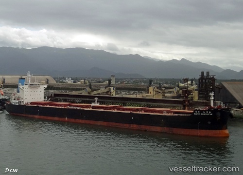
Sea Harmony
Current StatusWhere is the vessel?
Sea Harmony is currently in 15 nm S of Barra Grande, based on AIS data received about 1h ago.
Latest AIS update:
Current position: 13.28500° S, 38.65333° W (15 nm S of Barra Grande)
Average speed (last 7 days): Loading…
Average speed (last 30 days): Loading…
Vessel profile: Sea Harmony is a Bulk Carrier with dimensions 32m x 229m.
This page combines live AIS, route history, probable destination signals, nearby traffic, and port activity for practical vessel monitoring.
The current position of vessel Sea Harmony is -13.28500 lat / -38.65333 lng. Updated: 2026-03-26 19:28:38 UTCNearest reference points:
- Near Aracaju
- Near Barra dos Coqueiros
Details:
Live Vessel Sea Harmony Analytics (details, animations, etc.)
Recent AIS points (UTC):
2026-03-26 14:22:56 UTC · -13.28628, -38.65413 · SOG 0.1 kn · COG 118°2026-03-26 15:49:55 UTC · -13.28662, -38.65452 · SOG 0.1 kn · COG 101°
2026-03-26 18:01:55 UTC · -13.28554, -38.65383 · SOG 0.7 kn · COG 145°
2026-03-26 19:28:38 UTC · -13.28500, -38.65333 · SOG 0 kn · COG -1°