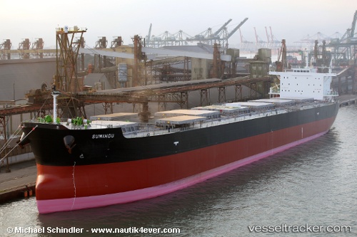
.
Vessel photo of MAGIC ECLIPSE (IMO 9597331) vesseltracker.com

MH flag MAGIC ECLIPSE

Vessel type: Bulk Carrier | IMO: 9597331 | MMSI: MMSI: 538009432
Call sign: V7A4732 | Dimensions: 32 m x 225 m
Current Status

Where is the vessel?

MAGIC ECLIPSE is currently in Near NISHI, based on AIS data received less than 1h ago.

Latest AIS update:

Current position: 42.99422° N, 144.33073° E (Near NISHI)

Average speed (last 7 days): Loading…

Average speed (last 30 days): Loading…

Vessel profile: MAGIC ECLIPSE is a Bulk Carrier with dimensions 32m x 225m.

This page combines live AIS, route history, probable destination signals, nearby traffic, and port activity for practical vessel monitoring.

The current position of vessel MAGIC ECLIPSE is 42.99422 lat / 144.33073 lng. Updated: 2026-04-01 00:05:20 UTC
Nearest reference points:
  • Near NISHI
  • Near Kushiro
  • 11 nm NE of Tomari

Currently sailing under the flag of Marshall Islands MH flag

MAGIC ECLIPSE built in 2011 year

Deadweight:
74940 t

Details:

Live Vessel MAGIC ECLIPSE Analytics (details, animations, etc.)


Recent AIS points (UTC):
2026-03-31 17:29:20 UTC · 42.99422, 144.33073 · SOG 0 kn · COG 94°
2026-03-31 19:32:20 UTC · 42.99422, 144.33075 · SOG 0 kn · COG 94°
2026-03-31 22:17:20 UTC · 42.99422, 144.33073 · SOG 0 kn · COG 94°
2026-04-01 00:05:20 UTC · 42.99422, 144.33073 · SOG 0 kn · COG 94°

Track of the vessel in the last 60 days


UTC: --
Start: -- Track timeline (UTC) End: --
Encountered: --


Link to the map:


Find another ship

MAGIC_ECLIPSE (538009432) last ports (portcalls and passsages)

North Pulau Laut | 2025-09-14 11:43:04
Guandu | 2025-09-02 13:42:10
ZHANJIANG | 2025-08-31 23:48:08
PENGERANG | 2025-08-26 01:23:12
TANAH MERAH | 2025-08-25 12:31:09
PULAU SAMBU | 2025-08-25 11:38:51
Cape Of Good Hope | 2025-06-24 05:46:07
PANAMBUR | 2025-06-04 11:39:25
Richards Bay | 2025-05-09 08:16:56
Richards Bay | 2025-05-02 07:51:16
KATTUPALLI | 2025-04-19 02:07:14
ENNORE | 2025-04-17 06:45:56
KATTUPALLI | 2025-04-15 00:46:57
ENNORE | 2025-04-11 02:38:12
KATTUPALLI | 2025-04-11 00:19:56
PULAU SAMBU | 2025-04-04 17:46:27
TANAH MERAH | 2025-04-04 04:28:08
PENGERANG | 2025-04-04 02:29:08
KARIANGAU | 2025-03-28 10:08:35
Davao | 2025-03-24 13:21:30
Davao | 2025-03-20 12:19:10
TANJUNG BARA | 2025-03-11 10:02:52
SUAL | 2025-03-07 09:18:27
SUAL | 2025-03-03 08:20:03
SUAL | 2025-02-27 07:16:05
SUAL | 2025-02-23 07:06:51
SUAL | 2025-02-19 03:36:10
SUAL | 2025-02-02 19:40:31
SUAL | 2025-01-29 19:03:19
MARIVELES | 2025-01-14 00:34:49
MARIVELES | 2025-01-09 23:57:27
LIMAY | 2025-01-08 18:26:45
LIMAY | 2025-01-04 18:23:12
MARIVELES | 2025-01-04 17:47:30
CAM PHA | 2024-12-18 06:21:45
CAM PHA | 2024-12-14 06:12:04
CAM PHA | 2024-12-10 05:44:29
PENGERANG | 2024-12-03 02:19:44
TANAH MERAH | 2024-12-02 13:51:34
PULAU SAMBU | 2024-12-02 12:26:24
BUKOM ISLAND | 2024-12-02 11:33:16
NACALA PORTO | 2024-11-16 14:11:04
Wakamatsu | 2024-09-12 04:06:45
Gladstone Harbor | 2024-08-12 04:03:32
Port Kembla | 2024-08-03 12:25:14
Ta-Ku | 2024-07-11 02:19:49
Taku Bar | 2024-07-11 00:30:11
Singapore | 2024-06-27 07:03:05
Port Kamsar | 2024-05-15 03:54:17
Strait Of Gibraltar | 2024-05-07 08:30:29
Algeciras | 2024-05-06 20:44:21
Gelibolu | 2024-04-29 02:08:55
Uskudar | 2024-04-28 08:28:40
Zonguldak | 2024-04-22 04:46:43
Uskudar | 2024-04-12 21:40:00
Marmara Island | 2024-04-10 06:10:00
Gelibolu | 2024-04-10 01:51:09
Canakkale | 2024-04-09 23:47:06
Strait Of Gibraltar | 2024-04-03 07:45:45
Stadersand | 2024-03-19 19:35:14
Port Kamsar | 2024-03-03 17:12:46
Panamburu | 2024-02-03 19:16:51
Singapore | 2024-01-19 20:49:40
Balikpapan | 2023-08-31 02:26:11
Singapore | 2023-08-26 02:47:59
Balikpapan | 2023-07-14 12:35:03
Balikpapan | 2023-06-02 03:46:30
Singapore | 2023-04-10 11:41:52