 vesseltracker.com
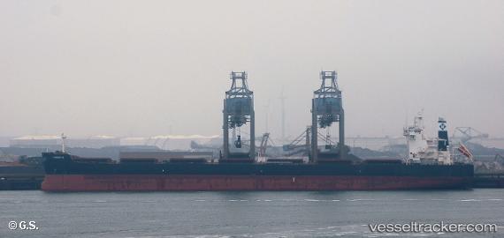
 Fiorela
Current Status
Where is the vessel?
Fiorela is currently in 134 nm W of Amini Island, based on AIS data received about 1h ago.
Latest AIS update:
Current position: 10.73921° N, 70.49289° E (134 nm W of Amini Island)
Average speed (last 7 days): Loading…
Average speed (last 30 days): Loading…
Vessel profile: Fiorela is a Bulk Carrier with dimensions 229m x 229m.
This page combines live AIS, route history, probable destination signals, nearby traffic, and port activity for practical vessel monitoring.
The current position of vessel Fiorela is 10.73921 lat / 70.49289 lng. Updated: 2026-04-03 12:47:51 UTCNearest reference points:
- 130 nm W of Lakshadweep
- 119 nm SE of Tinaquillo
- 13 nm NW of Lakshadweep
Currently sailing under the flag of Liberia ![]()
Fiorela built in 2011 year
Deadweight:
81501 tDetails:
Live Vessel Fiorela Analytics (details, animations, etc.)
Recent AIS points (UTC):
2026-04-03 04:16:33 UTC · 11.72219, 69.15070 · SOG 11.4 kn · COG 127°2026-04-03 04:16:33 UTC · 11.72219, 69.15070 · SOG 11.4 kn · COG 127°
2026-04-03 12:21:30 UTC · 10.79181, 70.42494 · SOG 11.5 kn · COG 128°
2026-04-03 12:47:51 UTC · 10.73921, 70.49289 · SOG 11.6 kn · COG 125°