 vesseltracker.com
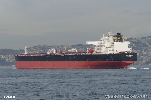
 NANTUCKET
Current Status
Where is the vessel?
NANTUCKET is currently in Near BUKOM ISLAND, based on AIS data received less than 1h ago.
Latest AIS update:
Current position: 1.15651° N, 103.77061° E (Near BUKOM ISLAND)
Average speed (last 7 days): Loading…
Average speed (last 30 days): Loading…
Vessel profile: NANTUCKET is a Crude Oil Tanker with dimensions 275m x 48m.
This page combines live AIS, route history, probable destination signals, nearby traffic, and port activity for practical vessel monitoring.
The current position of vessel NANTUCKET is 1.15651 lat / 103.77061 lng. Updated: 2026-04-19 14:05:48 UTCNearest reference points:
- Near BUKOM ISLAND
- Near Pasir Panjang Wharves
- Near JURONG ISLAND
Currently sailing under the flag of Liberia ![]()
NANTUCKET built in 2014 year
Deadweight:
156902 tDetails:
Live Vessel NANTUCKET Analytics (details, animations, etc.)
Recent AIS points (UTC):
2026-04-19 10:17:18 UTC · 1.26411, 103.91245 · SOG 0 kn · COG 88°2026-04-19 12:05:17 UTC · 1.26310, 103.91257 · SOG 0 kn · COG 65°
2026-04-19 13:44:24 UTC · 1.19502, 103.84838 · SOG 15.5 kn · COG 249°
2026-04-19 14:05:48 UTC · 1.15651, 103.77061 · SOG 14.3 kn · COG 237°