 vesseltracker.com
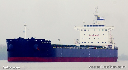
Densa Pelican
Current StatusWhere is the vessel?
Densa Pelican is currently in 11 nm SE of New Point, based on AIS data received less than 1h ago.
Latest AIS update:
Current position: 37.22390° N, 76.12750° W (11 nm SE of New Point)
Average speed (last 7 days): Loading…
Average speed (last 30 days): Loading…
Vessel profile: Densa Pelican is a Bulk Carrier with dimensions 32m x 229m.
This page combines live AIS, route history, probable destination signals, nearby traffic, and port activity for practical vessel monitoring.
The current position of vessel Densa Pelican is 37.2239 lat / -76.1275 lng. Updated: 2026-04-03 03:43:09 UTCNearest reference points:
- Near New Point
- Near Sewell's Point
- Near Hampton Roads Pt
Details:
Live Vessel Densa Pelican Analytics (details, animations, etc.)
Recent AIS points (UTC):
2026-04-02 22:07:09 UTC · 37.22110, -76.12960 · SOG 0 kn · COG 62°2026-04-02 23:49:08 UTC · 37.22240, -76.13040 · SOG 0.1 kn · COG 108°
2026-04-03 01:34:09 UTC · 37.22360, -76.12920 · SOG 0 kn · COG 149°
2026-04-03 03:43:09 UTC · 37.22390, -76.12750 · SOG 0 kn · COG 184°