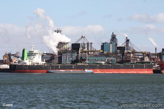
.
Vessel photo of Pacific West (IMO 9604029) vesseltracker.com

MH flag Pacific West

Vessel type: Bulk Carrier | IMO: 9604029 | MMSI: MMSI: 538004758
Call sign: V7YX5 | Dimensions: 292 m x 45 m
Current Status

Where is the vessel?

Pacific West is currently in 10 nm SE of ST FRANCIS, based on AIS data received less than 1h ago.

Latest AIS update:

Current position: 34.31794° S, 24.97749° E (10 nm SE of ST FRANCIS)

Average speed (last 7 days): Loading…

Average speed (last 30 days): Loading…

Vessel profile: Pacific West is a Bulk Carrier with dimensions 292m x 45m.

This page combines live AIS, route history, probable destination signals, nearby traffic, and port activity for practical vessel monitoring.

The current position of vessel Pacific West is -34.31794 lat / 24.97749 lng. Updated: 2026-03-29 15:42:29 UTC
Nearest reference points:
  • 21 nm S of Mount Pleasant
  • Near Deal Party

Currently sailing under the flag of Marshall Is MH flag

Details:

Live Vessel Pacific West Analytics (details, animations, etc.)


Recent AIS points (UTC):
2026-03-29 09:48:30 UTC · -34.07182, 26.11540 · SOG 10 kn · COG 255°
2026-03-29 12:10:59 UTC · -34.17617, 25.66236 · SOG 9.9 kn · COG 257°
2026-03-29 14:19:50 UTC · -34.25870, 25.24678 · SOG 9.7 kn · COG 252°
2026-03-29 15:42:29 UTC · -34.31794, 24.97749 · SOG 10.4 kn · COG 252°

Track of the vessel in the last 28 days


UTC: --
Start: -- Track timeline (UTC) End: --
Encountered: --


Link to the map:


Find another ship

Pacific_West (538004758) last ports (portcalls and passsages)

AL JUBAIL | 2025-09-14 12:15:09
Cape Of Good Hope | 2025-08-15 15:59:02
Narvik | 2025-07-12 19:59:26
MAASVLAKTE - ROTTERDAM | 2025-07-09 01:29:08
KRIMPEN | 2025-07-08 23:27:45
PARKHAVEN | 2025-07-07 08:35:24
ROTTERDAM PERNIS | 2025-07-07 08:02:50
BRIELLE | 2025-07-05 02:29:40
MAASVLAKTE - ROTTERDAM | 2025-07-05 01:06:09
BRIELLE | 2025-07-01 02:24:07
MAASVLAKTE - ROTTERDAM | 2025-06-30 23:44:18
BRIELLE | 2025-06-27 01:09:10
MAASVLAKTE - ROTTERDAM | 2025-06-26 23:08:28
BRIELLE | 2025-06-22 23:58:32
MAASVLAKTE - ROTTERDAM | 2025-06-22 22:32:43
Cape Of Good Hope | 2025-05-23 23:05:09
Wilson Promontory | 2025-04-21 05:14:52
Qingdao | 2025-03-08 04:22:00
LANSHAN | 2025-03-05 01:46:33
TANAH MERAH | 2025-02-17 06:51:07
BATU AMPAR | 2025-02-17 05:27:46
PULAU SAMBU | 2025-02-17 04:29:01
Cape Of Good Hope | 2024-12-07 12:10:18
GANGAVARAM | 2024-11-14 13:55:54
VISAKHAPATNAM | 2024-11-13 15:39:58
GANGAVARAM | 2024-11-10 13:29:29
VISAKHAPATNAM | 2024-11-09 15:37:08
Trincomalee | 2024-11-04 22:40:27
Port Louis | 2024-10-24 06:04:35
Sebang | 2024-07-20 18:09:45
Sambu | 2024-07-18 21:11:57
Taku Bar | 2024-07-08 11:02:11
Ta-Ku | 2024-07-04 14:26:45
Dagu Bar | 2024-07-04 11:06:12
Singapore | 2024-06-19 17:28:04
Sebang | 2024-06-17 06:56:58
Monrovia | 2024-05-04 10:20:04
Singapore | 2024-03-24 08:56:37
Taicang | 2024-02-26 08:10:48
Wusong | 2024-02-26 05:08:00
Jingjiang | 2024-02-26 00:02:19
Singapore | 2024-02-12 04:37:53
Strait Of Gibraltar | 2023-12-05 16:35:39
Algeciras | 2023-12-04 17:24:07
Strait Of Gibraltar | 2023-11-08 21:29:04
Saldanha Bay | 2023-10-16 05:15:16
Port Louis | 2023-09-17 05:23:12
Singapore | 2023-08-11 13:41:28
Port Des Galets | 2023-07-29 03:25:40
Bishop Rock | 2023-06-09 01:23:16
Stadersand | 2023-06-06 18:35:31
Cuxhaven | 2023-06-03 21:03:40
Saldanha Bay | 2023-05-06 11:59:19
Saldanha Bay | 2023-04-30 21:27:31
Taicang | 2023-02-22 08:32:41
Port Des Galets | 2022-11-28 02:03:16
Dampier | 2022-10-20 19:27:19
Selat Lombok | 2022-10-17 07:47:41
Newcastle | 2022-08-27 04:09:26
Wusong | 2022-08-03 19:57:05
Selat Lombok | 2022-07-14 07:48:27
Whyalla | 2022-06-28 04:59:57
Whyalla | 2022-06-24 04:10:28
Selat Lombok | 2022-05-16 22:59:00
Samson Point | 2022-05-10 04:10:38
Singapore | 2022-03-28 09:30:13
Jubail | 2021-12-29 20:53:42
Port Said | 2021-12-13 08:00:04
Strait Of Gibraltar | 2021-12-05 11:15:49