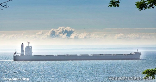
.
Vessel photo of Cape Sunrise (IMO 9605009) vesseltracker.com

Cape Sunrise

Vessel type: Bulk Carrier | IMO: 9605009 | MMSI: MMSI: 373058000
Call sign: 3FBQ6 | Dimensions: 45 m x 292 m
Current Status

Where is the vessel?

Cape Sunrise is currently in 53 nm N of Bangui, based on AIS data received less than 1h ago.

Latest AIS update:

Current position: 19.40864° N, 120.60114° E (53 nm N of Bangui)

Average speed (last 7 days): Loading…

Average speed (last 30 days): Loading…

Vessel profile: Cape Sunrise is a Bulk Carrier with dimensions 45m x 292m.

This page combines live AIS, route history, probable destination signals, nearby traffic, and port activity for practical vessel monitoring.

The current position of vessel Cape Sunrise is 19.40864 lat / 120.60114 lng. Updated: 2026-04-02 04:04:59 UTC
Nearest reference points:
  • 66 nm W of Basco
  • 106 nm W of Basco
  • 132 nm SW of Kaohsiung
Details:

Live Vessel Cape Sunrise Analytics (details, animations, etc.)


Recent AIS points (UTC):
2026-04-01 21:54:00 UTC · 20.77050, 120.95968 · SOG 12.4 kn · COG 191°
2026-04-02 00:22:30 UTC · 20.27548, 120.83501 · SOG 13.4 kn · COG 183°
2026-04-02 02:09:31 UTC · 19.84351, 120.75144 · SOG 14.6 kn · COG -1°
2026-04-02 04:04:59 UTC · 19.40864, 120.60114 · SOG 14.1 kn · COG -1°

Track of the vessel in the last 60 days


UTC: --
Start: -- Track timeline (UTC) End: --
Encountered: --


Link to the map:


Find another ship

Cape_Sunrise (373058000) last ports (portcalls and passsages)

Llanwrda | 2025-09-08 21:59:59
BRIELLE | 2025-09-08 11:14:43
Westvoorne | 2025-09-05 23:51:17
BRIELLE | 2025-09-04 06:00:38
PULAU SAMBU | 2025-07-11 07:59:07
Singapore | 2025-07-10 18:46:17
TANAH MERAH | 2025-07-10 15:52:53
PENGERANG | 2025-07-10 14:44:38
DUNG QUAT | 2025-07-05 10:13:31
Dung Quat Petroleum Port | 2025-07-02 23:47:56
DUNG QUAT | 2025-07-01 10:12:41
Selat Lombok | 2025-06-25 00:07:14
Port Headland | 2025-06-21 06:11:05
Port Hedland | 2025-06-21 04:41:15
Selat Lombok | 2025-06-16 22:22:26
PENGERANG | 2025-05-31 15:16:23
TANAH MERAH | 2025-05-31 03:14:52
BATU AMPAR | 2025-05-31 01:23:21
Port Etienne | 2025-04-25 17:27:53
Nouadhibou | 2025-04-25 15:28:18
CASADO | 2025-04-25 07:35:58
Nouadhibou | 2025-04-21 14:51:11
Port Etienne | 2025-04-21 12:57:06
CASADO | 2025-04-21 06:46:53
CASADO | 2025-04-17 06:11:45
CASADO | 2025-04-13 05:23:57
Port Etienne | 2025-04-10 15:32:36
CASADO | 2025-04-09 05:04:23
CASADO | 2025-04-05 03:42:34
CASADO | 2025-04-01 03:20:51
CASADO | 2025-03-28 01:59:34
CASADO | 2025-03-24 01:36:00
CASADO | 2025-03-20 01:10:38
CASADO | 2025-03-16 00:23:42
Port Etienne | 2025-03-15 22:54:49
BRIELLE | 2025-03-04 11:09:44
Maassluis | 2025-02-28 10:06:07
BRIELLE | 2025-02-28 08:53:17
Maassluis | 2025-02-24 10:01:17
BRIELLE | 2025-02-24 08:38:50
HOEK VAN HOLLAND | 2025-02-24 08:23:16
Yosu | 2024-11-18 15:53:02
Singapore | 2024-08-18 00:16:13
Cape Of Good Hope | 2024-07-26 02:45:48
Saldanha Bay | 2024-07-23 09:19:02
Ras Gharib | 2023-12-04 01:56:03
Bur Ibrahim | 2023-12-03 15:50:01
Port Said | 2023-12-03 05:58:15
Singapore | 2023-09-12 07:26:49
Rizhao | 2023-08-24 09:34:03
Selat Lombok | 2023-08-10 07:28:36
Samson Point | 2023-08-05 16:36:47
Jingjiang | 2023-07-23 12:19:58
Zhangjiagang | 2023-07-21 06:28:55
Taicang | 2023-07-21 00:09:12
Wusong | 2023-07-20 05:10:04
Saldanha Bay | 2023-06-11 11:20:12
Saldanha Bay | 2023-06-06 05:00:37
Cape Of Good Hope | 2023-04-14 09:23:01
Bur Ibrahim | 2023-03-12 05:28:25
Fujairah | 2023-03-02 05:34:50
Strait Of Gibraltar | 2023-01-02 02:47:53
Bur Ibrahim | 2022-12-25 05:52:37
Ras Gharib | 2022-11-24 23:41:45
Vancouver | 2022-07-25 01:38:34
Vancouver | 2022-07-21 01:32:53
Kamaishi | 2022-07-04 04:10:56
Honshu | 2022-07-02 22:07:58
Nagoya | 2022-07-01 10:07:44
Yokkaichi | 2022-06-30 22:27:16
Oita | 2022-06-29 04:45:56
Oita | 2022-06-25 04:29:01
Newcastle | 2022-06-08 04:17:22
Manila | 2022-05-05 19:05:01
Wusong | 2022-03-23 09:11:34
Saldanha Bay | 2022-01-28 04:50:16
Singapore | 2022-01-03 02:30:54
Selat Lombok | 2021-12-07 22:48:39
Dampier | 2021-12-03 06:00:16